Every year, thousands of people go missing in wilderness areas and disaster zones. Traditional ground searches waste precious hours covering limited terrain, while rescue teams risk their safety navigating hazardous conditions.
Search and rescue drones change this equation. At IE Drone Services, we’ve seen firsthand how thermal imaging and real-time aerial mapping compress response times from hours to minutes, giving emergency teams the intelligence they need when it matters most.
How Search and Rescue Drones See What Ground Teams Cannot
Real-Time Aerial Vision and Thermal Detection
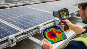
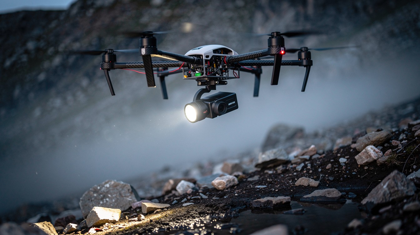
Search and rescue drones operate on a straightforward principle: they provide eyes in the sky where ground teams have none. The moment a drone launches, it captures real-time aerial video and thermal data simultaneously, feeding that intelligence directly to command centers and field coordinators. High-resolution visual cameras identify landmarks, terrain features, and potential victim locations with clarity that ground sweeps simply cannot match. Thermal sensors detect heat signatures from missing persons even in complete darkness, smoke, fog, and dense environments, which is why thermal imaging has become the backbone of modern SAR operations.
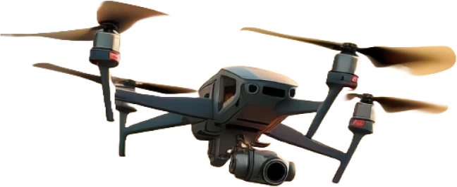
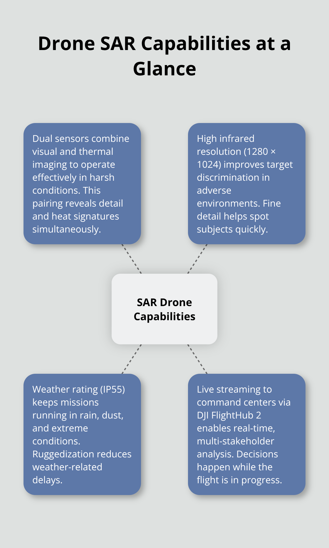
The Matrice 30T and Matrice 400 platforms that many agencies deploy carry both visual and thermal sensors rated for harsh weather. The 400 offers a robust 1280 × 1024 infrared resolution and IP55 rating for operations in rain, dust, and extreme conditions. Real-time video feeds stream to command centers via platforms like DJI FlightHub 2, allowing remote decision-makers to analyze drone footage simultaneously rather than waiting for data downloads after a mission ends.
Systematic Coverage That Eliminates Search Gaps
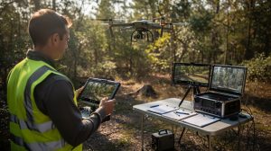
A critical advantage over ground searches emerges in how drones execute their missions. Drones follow systematic lawnmower-pattern flight paths that ensure complete area coverage, eliminating the human error that plagues manual sweeps across miles of terrain. Operators can program these patterns in advance, allowing the drone to work autonomously while the pilot monitors thermal feeds for heat signatures. This structured approach means rescue teams waste no effort on areas already searched, concentrating resources where they matter most.
Speed Across Impossible Terrain
The speed difference between drone reconnaissance and traditional methods is the real game-changer. Drones reach remote cliffs, dense forests, rivers, and avalanche zones in minutes-areas that would take ground teams hours or days to access safely. Thermal imaging works best when infrared contrast is highest, which occurs in cooler conditions where a missing person’s body heat stands out dramatically against the environment. Operators select White Hot or Black Hot thermal palettes to maximize contrast and speed victim identification during live video review.
Precision Coordination for Ground Teams
Once a subject is located, drones broadcast the exact GPS coordinates to ground teams via QR codes or FlightHub 2, enabling precise navigation to the victim without additional search time. The Matrice 400’s six-direction sensing and LiDAR capabilities allow operators to navigate dense vegetation and complex terrain autonomously, reducing pilot workload and the risk of crashes that could delay rescue operations further. Rapid 2D mapping on FlightHub 2 creates searchable area visualizations overlaid with last-known locations and terrain hazards, helping coordinators deploy rescue teams to the highest-probability zones first.
These capabilities transform how emergency responders approach missing person cases. Rather than spreading teams thin across vast areas, SAR operations now concentrate on data-driven zones where thermal detection and aerial mapping point them toward success. The next section examines how these technologies translate into real-world emergency response scenarios across different environments and disaster types.
Where Search and Rescue Drones Deliver Real Results
Wilderness Searches That Thermal Imaging Transforms
Wilderness search operations demonstrate why thermal drones have become indispensable to modern rescue work. When the New York State Police deployed drones in the Adirondacks in 2019 to locate a lost hiker, thermal imaging cut search time dramatically compared to ground teams combing dense forest. The UK’s Maritime and Coastguard Agency now routinely uses drones for coastal and remote-area searches, including high-profile operations in the Scottish Highlands where terrain makes ground access dangerous and slow. Swiss Alpine Rescue deployed thermal drones in 2022 to locate climbers during an avalanche, proving that drones work effectively in extreme weather and harsh mountain conditions where traditional rescue methods fail.
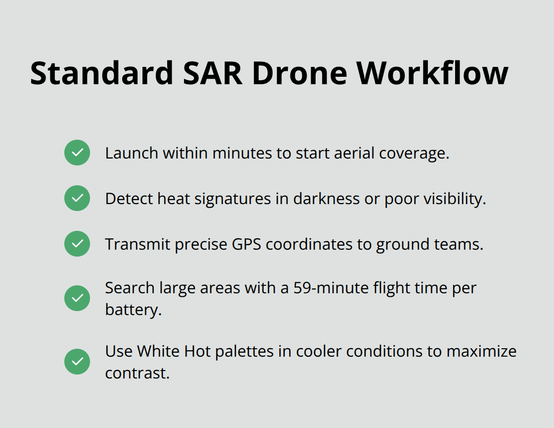
These operations share a common pattern: drones launch within minutes, thermal sensors identify heat signatures in darkness or poor visibility, and ground teams receive precise coordinates to reach victims faster. The Matrice 400’s 59-minute flight time means operators can search large wilderness zones on a single battery, reducing the need for multiple sorties that waste critical hours. Operators should select White Hot thermal palettes in cooler conditions to maximize contrast between a person’s body heat and the surrounding environment-this simple adjustment dramatically improves detection speed during live video review.
Disaster Assessment at Scale After Major Events
Disaster assessment after hurricanes, floods, and earthquakes shows drones solving a different problem: situational awareness across entire impact zones. After Hurricane Harvey in 2018, TEEX Urban Search and Rescue deployed drones to assess flood zones and locate stranded people, enabling coordinators to direct ground teams to areas of highest need rather than sending crews blindly into hazardous water. The Matrice 30T’s IP54 rating and the Matrice 400’s IP55 rating allow operations in rain, wind, and dust without weather delays that ground teams experience.
Real-time video feeds via DJI FlightHub 2 let incident commanders see damage patterns, identify blocked roads, and spot victims from a central command post rather than waiting for radio reports from scattered field teams. GPS coordinates and 2D mapping generated during flights guide ground personnel to specific locations, eliminating confusion about where to search next. This direct integration between aerial intelligence and ground coordination compresses decision cycles from hours to minutes-the difference between reaching someone in time and arriving too late.
Coordinating Response Teams Through Aerial Data
Ground teams now rely on drone-generated intelligence to execute rescues with precision rather than guesswork. Incident commanders receive live thermal feeds showing exactly where heat signatures appear, allowing them to position rescue personnel at the highest-probability locations before ground searches even begin. The speed of this coordination matters enormously in time-critical situations where every minute affects survival outcomes.
Agencies across the country have recognized this advantage, which is why more than 500 US SAR teams now operate drones as standard equipment. The shift from traditional ground-only methods to drone-supported operations reflects a fundamental change in how emergency responders approach missing person cases and disaster zones. As thermal technology improves and flight times extend, the question for emergency services is no longer whether to use drones, but how to integrate them into existing command structures and training protocols.
Why Ground Searches Fail When Speed Matters
Coverage Speed Cannot Match Aerial Reconnaissance
Ground-based search operations face an insurmountable problem: coverage speed and area capacity shrink dramatically as terrain complexity increases. A ground team searching a wilderness zone covers roughly one to two square miles per day under ideal conditions, moving slowly through dense vegetation, rocky slopes, and water obstacles that impede every step. When a missing person vanishes in a 50-square-mile search area, ground teams need 25 to 50 days to conduct even a basic sweep-time that most survival situations simply do not provide. Drones cover that same 50-square-mile zone in 2 to 3 hours with systematic lawnmower-pattern flights, delivering thermal imagery and GPS coordinates that tell rescue teams exactly where to deploy personnel. The difference between a ground-only approach and drone-supported operations is not incremental; it is the difference between finding someone alive and conducting a recovery operation.
Personnel Safety Collapses in Hazardous Environments
Personnel safety represents the second critical failure of traditional methods. Ground teams searching avalanche terrain, flood zones, unstable structures, and wildlife-dense forests expose rescuers to the same hazards threatening the missing person. After Hurricane Harvey in 2018, TEEX Urban Search and Rescue teams navigated flooded areas and faced drowning risks, contaminated water exposure, and hidden debris hazards that slowed their operations and endangered their lives.
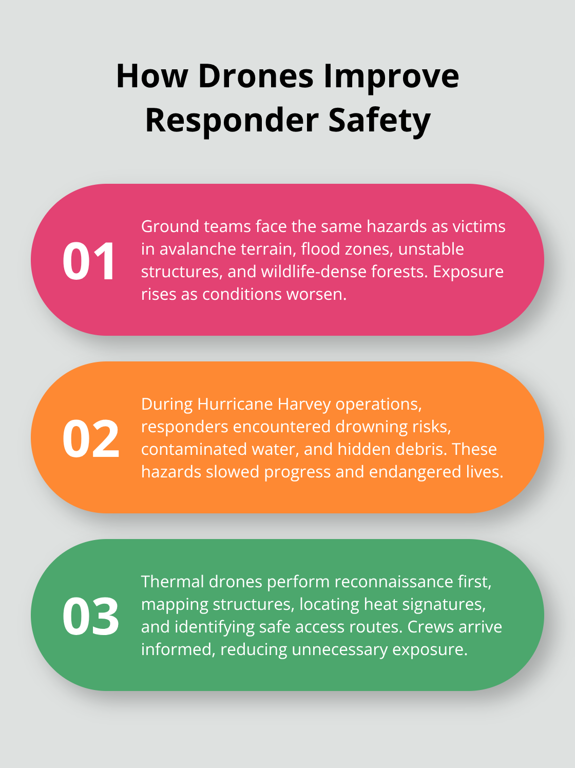
Drones eliminate this exposure entirely by providing aerial reconnaissance before ground personnel ever enter dangerous zones. A thermal drone can map a collapsed building, identify heat signatures of trapped occupants, and pinpoint safe access routes-all without sending rescue workers into structural collapse zones or hazardous environments. This reconnaissance capability means ground teams arrive with complete situational awareness rather than entering blind, which accelerates rescue execution and prevents preventable injuries to responders. Agencies deploying drones as first responders report faster incident assessments and measurably reduced risk exposure to their personnel compared to traditional ground-first approaches.
Real-Time Intelligence Transforms Decision-Making
The third failure mode strikes at the operational core: ground teams generate data slowly while decision-makers wait for information. Traditional SAR operations rely on radio reports from scattered field teams, verbal descriptions of terrain features, and delayed updates that lag real conditions by hours. An incident commander directing multiple ground teams across a large search zone receives fragmented information, guesses about which areas have been thoroughly searched, and incomplete pictures of terrain hazards. Drones transmit live video feeds to command centers via platforms like DJI FlightHub 2, allowing incident commanders to see the search area in real time, identify heat signatures during live thermal review, and adjust team deployment instantly. This real-time intelligence compresses decision cycles from hours to minutes. When a thermal signature appears on live drone video, coordinators immediately dispatch ground crews with precise GPS coordinates rather than waiting for field teams to radio back their observations. The speed of this feedback loop determines whether rescue operations concentrate resources on high-probability zones or waste effort on areas already cleared. More than 500 US SAR teams now operate drones as standard equipment, reflecting the operational reality that ground-only searches cannot compete with drone-supported response times in any meaningful way.
Final Thoughts
Search and rescue drones have fundamentally transformed how emergency responders locate missing persons and assess disaster zones. Thermal imaging identifies heat signatures in darkness and poor visibility, while real-time video feeds to command centers compress decision-making from hours to minutes. Ground teams no longer enter hazardous environments blind; instead, they receive precise GPS coordinates and aerial intelligence that directs personnel to the highest-probability locations with confidence.
Adoption across emergency services reflects this operational shift. More than 500 US SAR teams now operate drones as standard equipment, and agencies from the UK Maritime and Coastguard Agency to Swiss Alpine Rescue have integrated thermal drones into their response protocols. FAA Part 107 certification and BVLOS waivers have expanded operational scope, enabling long-range reconnaissance in remote areas where traditional methods fail entirely.
We at IE Drone Services bring FAA certification and operational experience with DJI platforms equipped with high-resolution and infrared cameras specifically designed for search and rescue drone operations. Our team handles the complexity of airspace authorization, thermal imaging interpretation, and real-time coordination with your incident command structure. Contact us to discuss how thermal drone capabilities can accelerate your team’s response times and improve outcomes in your next missing person case or disaster assessment.