Every year, thousands of people go missing in remote areas, and traditional search methods often take too long to cover ground effectively. Volunteer search drone operations have become a game-changer for rescue teams, cutting response times and expanding coverage in ways that ground crews simply cannot match.
At IE Drone Services, we’ve seen firsthand how organized volunteer drone programs save lives. This guide walks you through how drones are transforming rescue missions, what volunteer operators need to know, and how communities can build effective search programs.
How Drones Cover Search Areas Faster Than Ground Teams
Drones fundamentally change how rescue teams approach missing person searches. A ground crew covering a square mile of terrain takes hours or days, while a drone covers the same area in minutes. The DJI Matrice 350 RTK delivers around 55 minutes of flight time with a 15 km range, allowing operators to scan vast wilderness sections in a single sortie. This speed matters because missing persons in remote areas face exposure, injury, and deteriorating conditions. According to research from UAV Coach, drones function as force multipliers by expanding search areas and delivering real-time video to Incident Command, which directly accelerates decision-making.
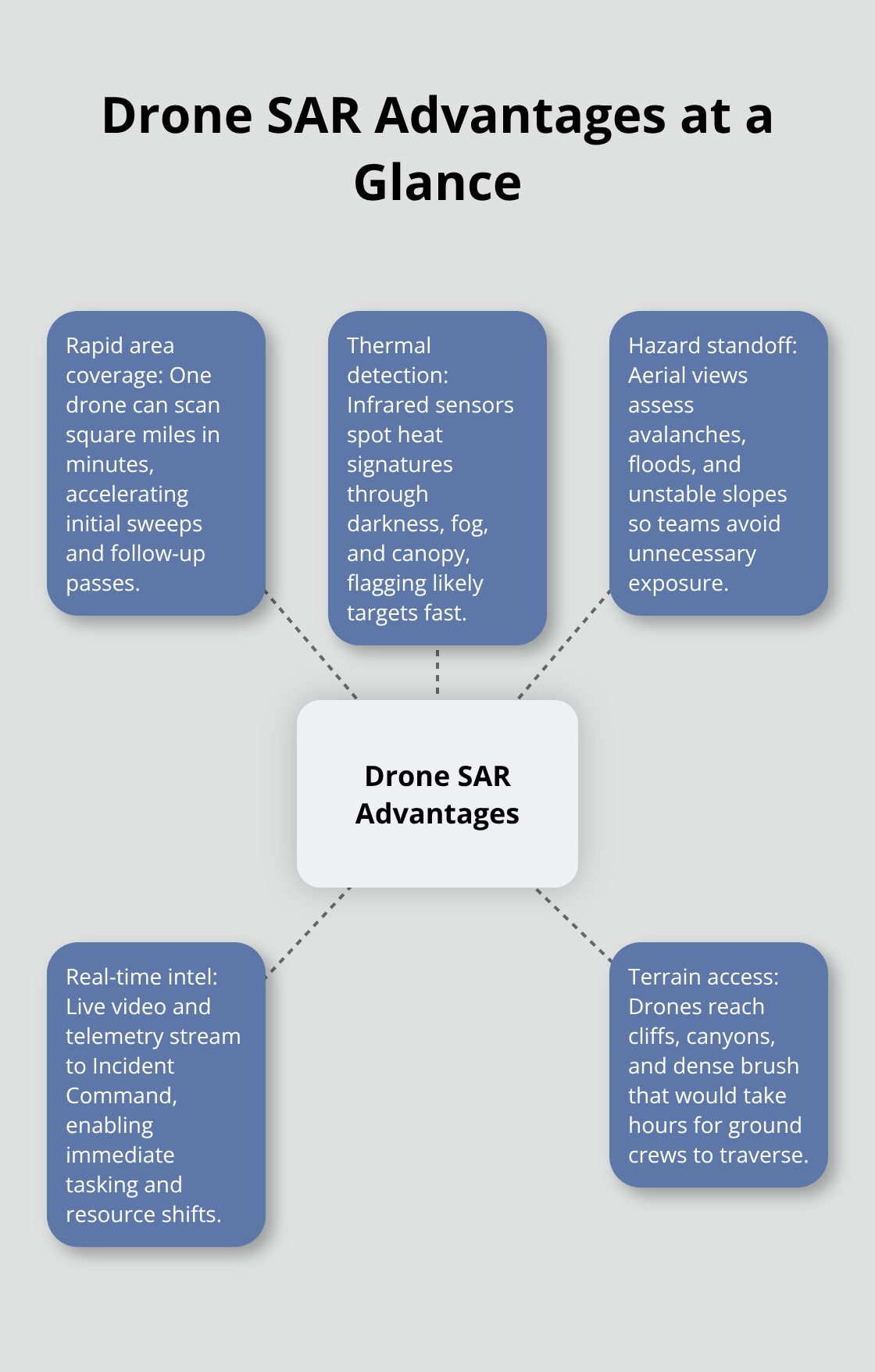
In alpine terrain or dense forests, ground teams waste energy bushwhacking through obstacles while drones bypass those limitations entirely, covering elevation changes and inaccessible zones that would take searchers hours to reach on foot.
Thermal imaging detects people ground crews cannot locate
The real advantage emerges when darkness, fog, or heavy vegetation blocks visibility. Thermal cameras detect heat signatures regardless of visibility conditions, which ground teams cannot replicate. The FLIR SIRAS and Parrot ANAFI USA both include thermal imaging specifically because heat detection works in low-visibility scenarios where visual searches fail. A person hidden in dense forest or obscured by smoke becomes visible to infrared sensors, cutting search time dramatically. This capability reduces the physical toll on rescuers who might otherwise spend entire nights walking search grids with flashlights, and it increases the probability of locating missing persons before conditions become life-threatening. Real-time thermal data streams directly to command centers, allowing incident commanders to redirect resources instantly when a detection occurs rather than waiting for ground teams to report back.
Drones eliminate rescuer exposure to hazardous terrain
Ground searches in hazardous terrain injure rescuers regularly. Steep slopes, unstable snow, flooded areas, and avalanche terrain all pose risks to people on foot. Drones assess dangerous areas before sending in ground crews, allowing teams to identify hazards like unstable terrain, structural damage, or environmental threats from above. Instead of sending searchers into an unstable area to assess conditions, a drone captures high-resolution imagery and thermal data from above, allowing teams to plan safer approaches and identify hazards before personnel enter. Volunteer drone operators in Colorado and across the US have demonstrated that organized programs lower rescuer injuries while accelerating mission outcomes. The data collected from drones informs resource allocation and triage decisions, meaning ground teams deploy strategically rather than blindly searching high-risk zones.
Understanding these advantages sets the foundation for how volunteer networks actually operate in the field. The next section explores how organized volunteer drone programs expand rescue capabilities and what training volunteer operators need to participate effectively in search missions.
Building Effective Volunteer Drone Networks for Search Operations
How Volunteer Networks Activate Rapid Response
Across the United States, over 500 search and rescue teams now operate drones as core assets in missing person missions, according to data from DJI. These programs require structured volunteer networks that connect trained operators with incident commanders in ways that integrate seamlessly into existing emergency response frameworks. Volunteer drone programs expand search capabilities by positioning operators strategically across regions, reducing response time significantly. When a person goes missing in a remote area, established volunteer networks activate pre-positioned teams who launch within the golden hour-the critical window when rescue outcomes improve dramatically.
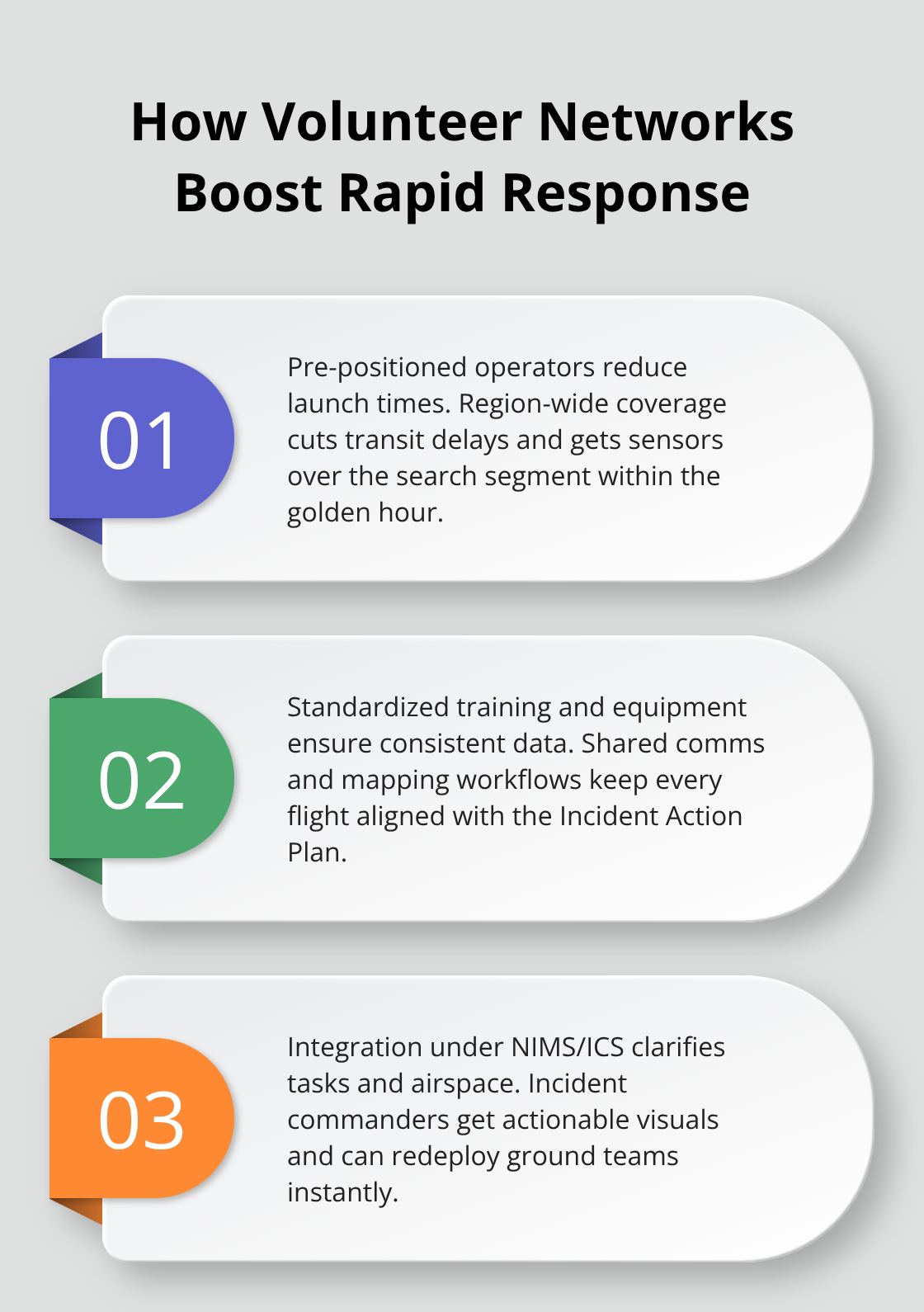
The most effective programs operate through organized systems where volunteers commit to training schedules, maintain equipment standards, and understand their role within the broader incident command structure. Colorado’s interagency SAR training demonstrates this principle: multi-agency collaboration with shared standards and unified communication protocols enables faster information flow during actual missions. Volunteer operators in these programs function as integrated assets within NIMS frameworks that guide all US emergency response, not as isolated hobbyists. This structure means volunteers receive clear objectives, understand resource allocation priorities, and know exactly how their aerial data feeds into command decisions.
Training Requirements That Build Competent Operators
Training and certification requirements vary by jurisdiction, but the most credible volunteer programs demand FAA Part 107 certification as a baseline requirement, supplemented by SAR-specific instruction that covers thermal imaging interpretation, mission planning in alpine terrain, and airspace coordination with manned aircraft. Volunteers must understand that thermal signatures require expertise to interpret correctly-a heat signature might be equipment, wildlife, or a person, and misidentification wastes resources.
Real-world SAR operations demand pilots who can fly at high altitudes in complex terrain, maintain persistent connectivity through poor signal areas, and adapt grid patterns based on terrain features and search segment priorities. Scenario-based training at elevations between 8,500 and 12,500 feet, as practiced in Colorado SAR networks, builds the terrain-aware piloting skills volunteers need when ground conditions change rapidly.
Coordination Protocols That Prevent Conflicts
Coordination with official emergency response teams requires volunteers to accept the Air Boss role-the designated person managing airspace deconfliction when helicopters or fixed-wing aircraft operate nearby. This responsibility isn’t optional; it’s a safety and legal requirement that prevents collisions and ensures unified command. After-action reviews following each mission feed directly into standard operating procedures and training objectives, meaning volunteer programs continuously improve based on real mission experience rather than remaining static.
Communities benefit most when volunteer drone programs operate with documented protocols, regular training cycles, and clear communication channels to county sheriffs and search management teams who coordinate actual rescue operations. These structured approaches transform volunteer enthusiasm into reliable, mission-critical assets that incident commanders can trust and deploy with confidence. The next section examines the specific operational practices that separate effective volunteer programs from those that struggle to integrate into real rescue missions.
Operating Drones Safely in Real Search Missions
Volunteer drone operators in active search missions face constraints that recreational flying never presents. You operate under incident command authority, coordinate with helicopters and manned aircraft, work in unpredictable weather, and deliver data that directly influences where ground teams deploy.
Plan Missions Before You Launch
Pre-mission planning separates operators who contribute meaningfully from those who waste incident commander time. Obtain the search segment boundaries, terrain elevation data, and any airspace restrictions from the incident commander or search management team before launching. CalTopo integration, as practiced in Colorado SAR networks, enables instant sharing of flight plans and orthomosaics with unified command, aligning your operations with the Incident Action Plan rather than operating independently.
High-altitude UAS operations in alpine terrain require terrain-aware flight planning, and forward staging your equipment near the search segment reduces battery depletion from travel time and improves sortie efficiency significantly.
Prepare Equipment With Precision
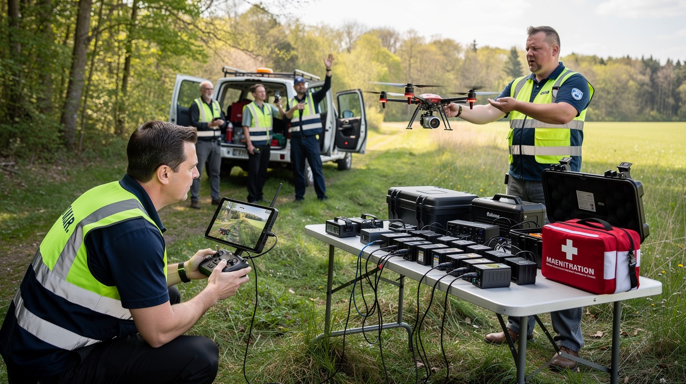
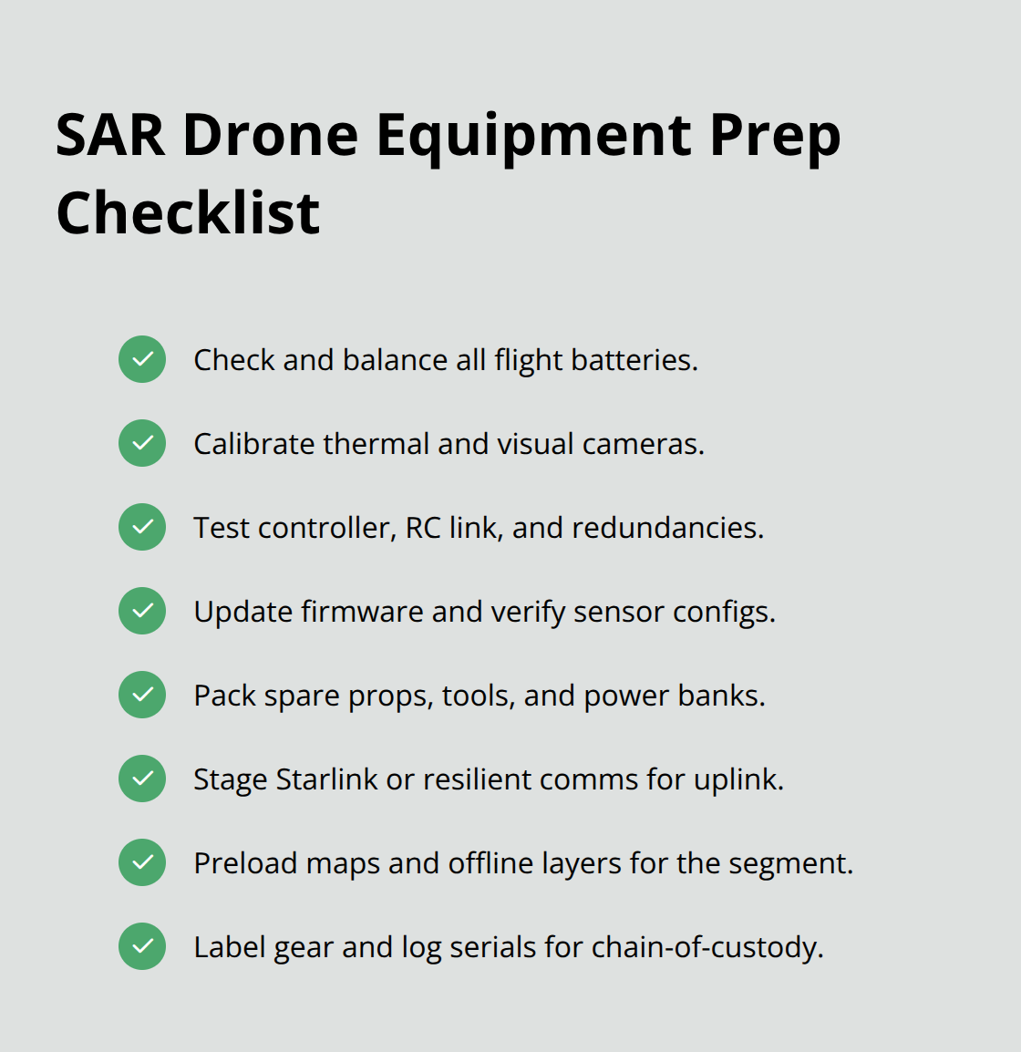
Equipment preparation determines mission success before you ever launch. Verify battery health, thermal camera calibration, and communication systems before arriving at the incident area rather than troubleshooting problems when the golden hour slips away. Persistent connectivity through Starlink or similar systems becomes critical in alpine environments where traditional radio links fail, maintaining video and data flow to incident command when standard communications degrade.
Navigate Weather and Environmental Limits
Weather decisions demand absolute clarity because mountain conditions change rapidly and thermal imaging performance degrades in precipitation. Thermal cameras lose effectiveness in rain and heavy snow, so operators must assess conditions honestly and delay flights when weather compromises data quality. This discipline protects both personnel and mission integrity.
Communicate Data in Actionable Formats
Communication protocols matter more than equipment specifications because misaligned mapping workflows or inconsistent coordinate formats create friction that slows response. Eagle Eyes live-detection overlays integrated with CalTopo provide real-time detections directly to the Search Management Team, eliminating delays from manual data review. After-action reviews following each mission feed updates into standard operating procedures, meaning your volunteer program continuously strengthens based on actual mission experience rather than remaining static.
Operators who integrate seamlessly into command structures, maintain equipment reliability, and communicate data in formats that incident commanders can act on immediately accelerate rescue outcomes significantly.
Final Thoughts
Volunteer search drone operations have transformed from experimental projects into essential components of modern rescue infrastructure. Over 500 SAR teams across the United States now integrate drones into their response protocols, and this growth reflects a fundamental shift in how communities approach missing person searches. The data proves it: drones reduce response times, expand coverage into terrain that ground crews cannot reach efficiently, and provide thermal detection capabilities that save lives in low-visibility conditions.
Communities that build organized volunteer drone programs gain measurable advantages through structured training, clear coordination protocols, and integration into incident command systems. Structured training, clear coordination protocols, and integration into incident command systems transform volunteer enthusiasm into reliable assets that incident commanders trust completely. Colorado’s interagency SAR training demonstrates this principle repeatedly-multi-agency collaboration with unified standards accelerates information flow and improves mission outcomes significantly.
Start by connecting with your local SAR team or county sheriff’s office to understand their drone program status and training requirements. Pursue FAA Part 107 certification as your foundation, then seek SAR-specific instruction that covers thermal imaging interpretation, alpine terrain operations, and airspace coordination. If your community is building or strengthening a volunteer drone program, contact IE Drone Services to discuss how professional expertise and proven equipment can support your team’s training and operational readiness.