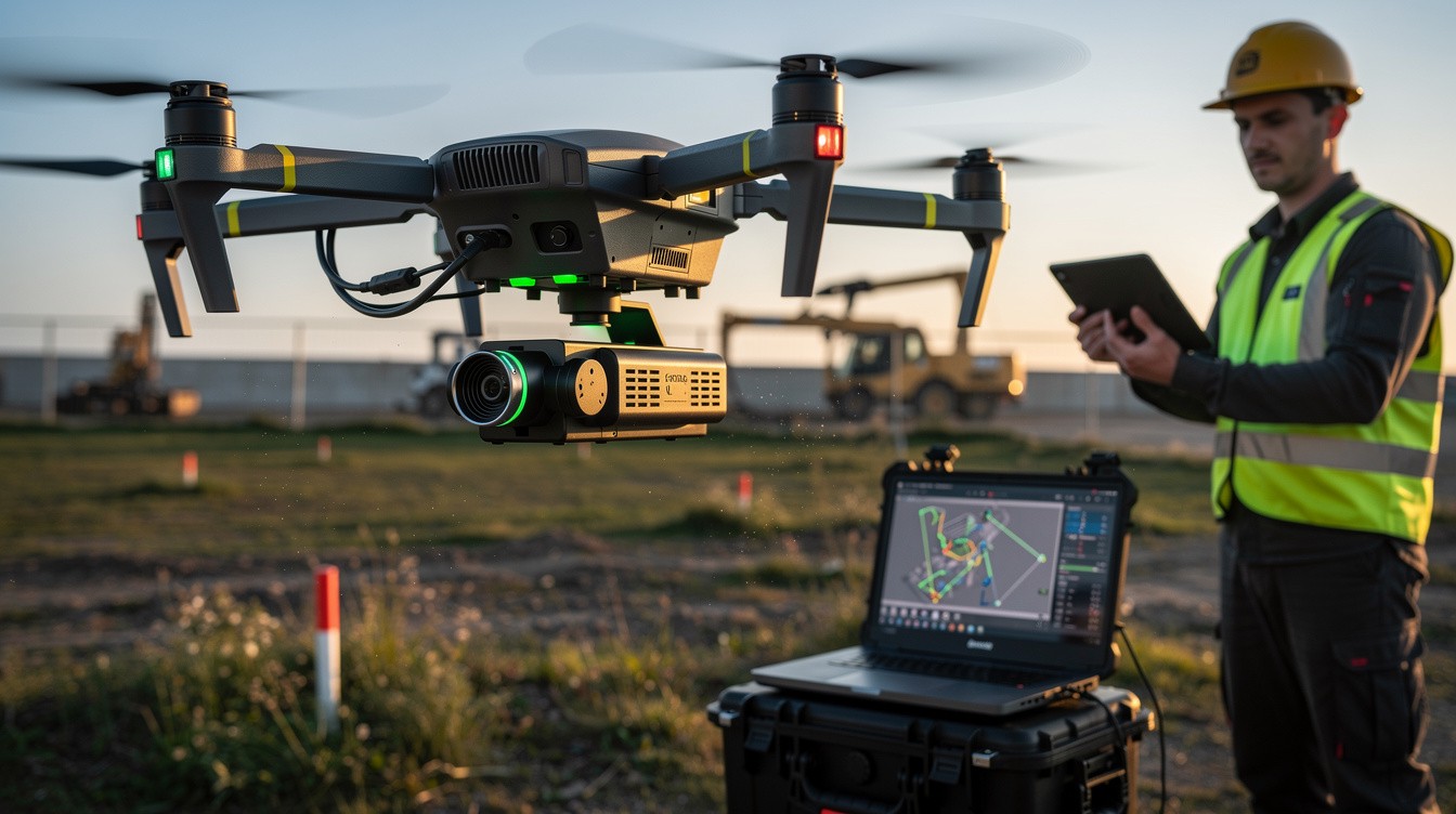
Drone LiDAR mapping has transformed how professionals measure and analyze terrain, buildings, and landscapes. This technology captures precise 3D data in ways traditional surveying simply cannot match.
At IE Drone Services, we’ve seen firsthand how a drone with LiDAR mapping capabilities delivers faster results, reduces costs, and improves safety on job sites. This guide walks you through everything you need to know to implement this technology effectively.
How LiDAR Technology Works on Drones
Understanding LiDAR Fundamentals
LiDAR stands for Light Imaging Detection and Ranging, and it operates by emitting laser pulses toward the ground and measuring how long those pulses take to return. A drone-mounted LiDAR sensor fires thousands of these pulses per second, creating a dense point cloud that represents terrain, vegetation, and structures in three dimensions. The system pairs this laser data with GPS and inertial measurement units to georeference each point, meaning every data point receives a precise coordinate. This combination produces accuracy levels that traditional ground surveying simply cannot achieve.
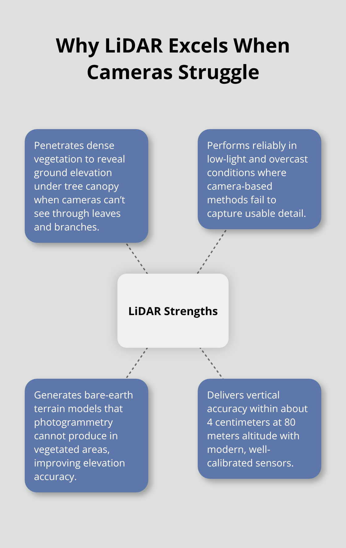
At 80 meters altitude with proper calibration, modern LiDAR sensors like the DJI Zenmuse L2 deliver vertical accuracy within 4 centimeters. The real advantage emerges when you need ground elevation beneath dense forest canopy or in low-light conditions where cameras fail completely. LiDAR pulses penetrate vegetation and work equally well on overcast days, revealing bare-earth terrain that photogrammetry cannot detect.
Why LiDAR Outperforms Cameras in Challenging Conditions
This capability makes LiDAR the only realistic choice for projects like powerline corridor mapping, where you need accurate ground elevation under tree cover, or forested sites where topographic precision matters more than visual imagery. Cameras struggle with shadows, dense vegetation, and poor lighting, but LiDAR ignores these obstacles entirely. The laser returns ground elevation even when trees block the view, something no camera-based system can accomplish.
Flight Planning and Data Collection Strategy
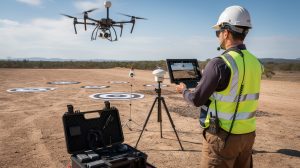
The practical workflow starts with flight planning software that calculates altitude, speed, and line spacing based on your target point density. Most surveying work requires 20 to 50 points per square meter, while powerline inspections demand higher densities, and detailed infrastructure work needs even more. Flying at 80 meters with a 70-degree field of view creates roughly a 110-meter ground swath, while a 105-degree field of view doubles that to 210 meters per pass.
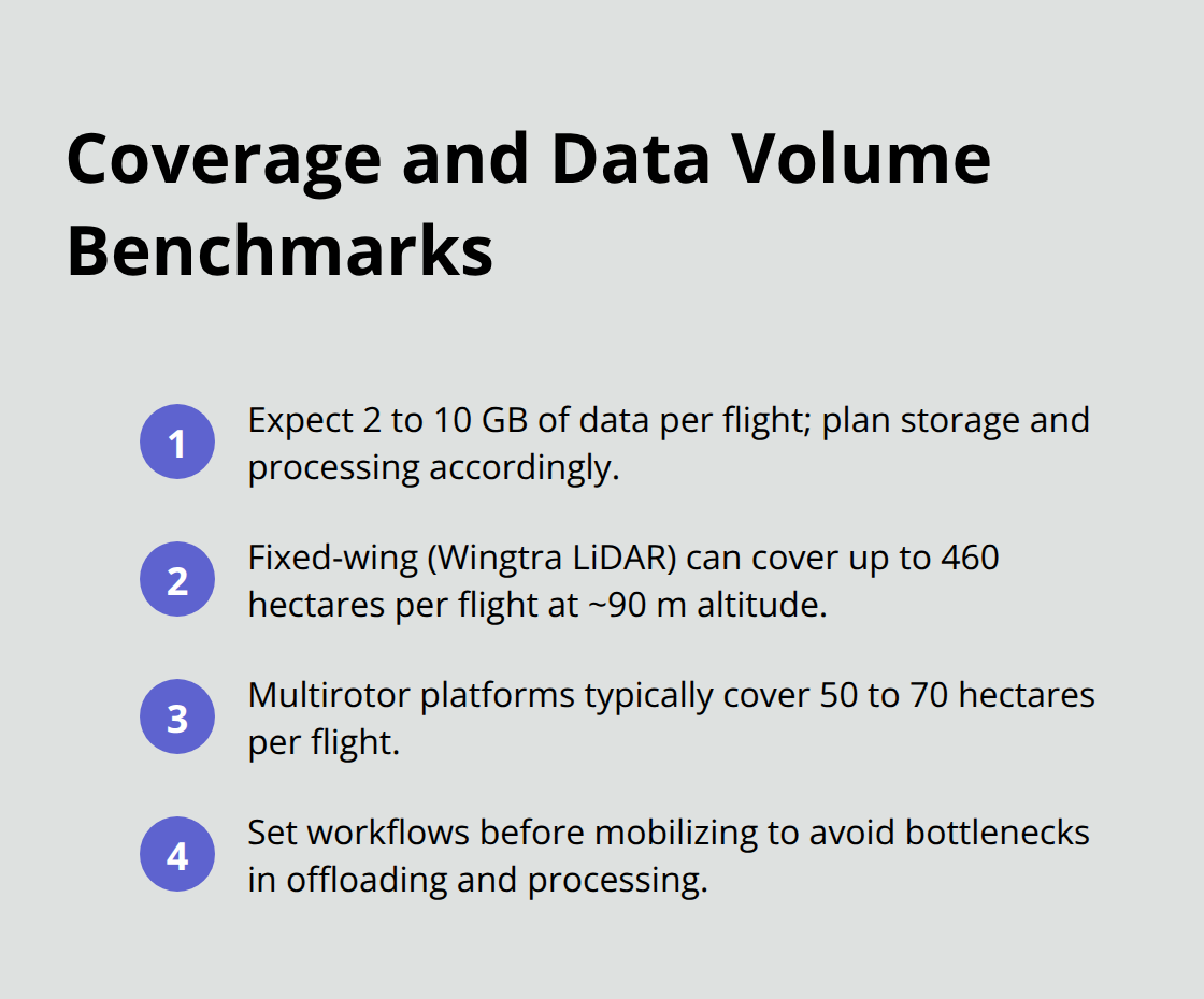
Data collection typically generates 2 to 10 gigabytes per flight, so you need robust storage and processing workflows before mobilizing equipment. Fixed-wing options like the Wingtra LiDAR system extend large-area capability dramatically, covering up to 460 hectares in a single flight at 90 meters altitude, compared to 50 to 70 hectares for multirotor platforms.
Processing Raw Data Into Actionable Models
Post-processing involves classifying the raw point cloud, removing noise, extracting digital elevation models, and validating accuracy against ground control points measured with survey-grade GPS. For a 50-hectare site, expect 4 to 8 hours of processing time after flight completion. The entire workflow from planning through delivery takes days rather than weeks, which explains why drone LiDAR costs $50 to $150 per acre for open ground.
Organizations across construction, forestry, infrastructure, and environmental monitoring have adopted this technology because it delivers results faster and more cost-effectively than traditional methods. The next section explores how these results translate into real-world applications across different industries and project types.
Real-World Applications of Drone LiDAR Mapping
Construction and Stockpile Measurement
Drone LiDAR excels in construction environments where accurate volume calculations determine project profitability. Contractors measure stockpiles with precision that eliminates costly disputes over material quantities. A stockpile survey costs $800 to $1,200 for 5 to 10 acres when performed with drone LiDAR, compared to weeks of ground-based measurements that tie up crews and equipment. Volumetric calculations from point clouds reveal material quantities within centimeters of accuracy, allowing contractors to bill clients with confidence and keep project budgets tight.
Earthwork planning accelerates dramatically because LiDAR generates contours and digital terrain models in days rather than months. Construction managers finalize grading plans and equipment logistics before mobilization begins, reducing delays and unexpected costs. The technology transforms how teams approach site preparation and material management across the entire project lifecycle.
Infrastructure Inspection and Safety
Infrastructure inspection represents the most dangerous application where drone LiDAR creates measurable safety improvements. Powerline maintenance crews face serious risks climbing poles and towers to measure clearances and identify vegetation threats. Drone LiDAR maps entire corridors in a single flight, capturing ground elevation beneath trees and detecting which sections require trimming work. Powerline maintenance and vegetation threat detection requires 100 to 200 points per square meter to capture wire geometry and vegetation clearance, and a single flight covers 50 to 70 hectares depending on the platform.
Bridge inspections and pipeline monitoring similarly benefit because LiDAR produces high-detail 3D data without requiring personnel to access difficult or unstable structures. The technology eliminates exposure to falls, electrical hazards, and confined spaces that traditional inspection methods demand. Teams obtain comprehensive structural data while keeping workers on solid ground.
Environmental and Natural Resource Applications
Environmental professionals track coastal erosion and riverbank stability by comparing LiDAR datasets from multiple years, revealing centimeter-level terrain changes that visual inspection cannot detect. Forest management teams measure tree height and canopy density to estimate biomass and plan reforestation efforts with precision that supports regulatory compliance and carbon accounting. Archaeological work relies on LiDAR’s ability to penetrate dense vegetation and reveal hidden structures beneath forest canopy, exposing site layouts that ground surveys would miss entirely.
These applications demonstrate why LiDAR has become the standard across industries where accuracy, safety, and speed matter most. Understanding how to plan and execute these projects effectively requires attention to specific techniques that maximize data quality and minimize costs. The next section covers the practical steps that separate successful LiDAR projects from those that waste time and resources.
Best Practices for Implementing Drone LiDAR Mapping Projects
Define Your Deliverable and Work Backward
Success with drone LiDAR depends entirely on decisions made before the drone leaves the ground. Most projects fail because teams skip proper planning and rush into data collection, then waste weeks fixing problems that better preparation would have prevented. Start by defining your deliverable first, then work backward to determine the point density you actually need. A stockpile volume calculation requires different precision than powerline clearance mapping, and those differ again from archaeological site documentation. Once you know what accuracy matters, you can select flight altitude, sensor configuration, and line spacing accordingly.
For open ground surveying, 20 to 50 points per square meter suffices, but powerline corridors demand 100 to 200 points per square meter to capture wire geometry reliably. Detailed infrastructure work requires even higher densities. Planning software like UgCS LiDAR Area automatically computes these parameters based on your sensor’s field of view and target density, eliminating guesswork and preventing expensive re-flights.
Prepare Your Flight Plan and Site Setup
Load your site terrain data into the planning software to activate terrain-following flight modes that maintain consistent ground clearance across variable topography. This prevents altitude fluctuations that degrade point density consistency. Add obstacle clearance buffers around trees, structures, and terrain features so the drone maintains safe separation without manual intervention. Verify your complete flight path in 3D view before launching any equipment.
Weather conditions matter more than many operators realize: ideal conditions are overcast days with winds below 8 meters per second and temperatures between 10 and 30 degrees Celsius. Cloud cover does not affect laser returns, but winds above 8 meters per second begin degrading accuracy, and anything above 12 meters per second is risky. Rain and fog block laser performance entirely, so never attempt LiDAR surveys in precipitation.
Execute Data Collection With Precision
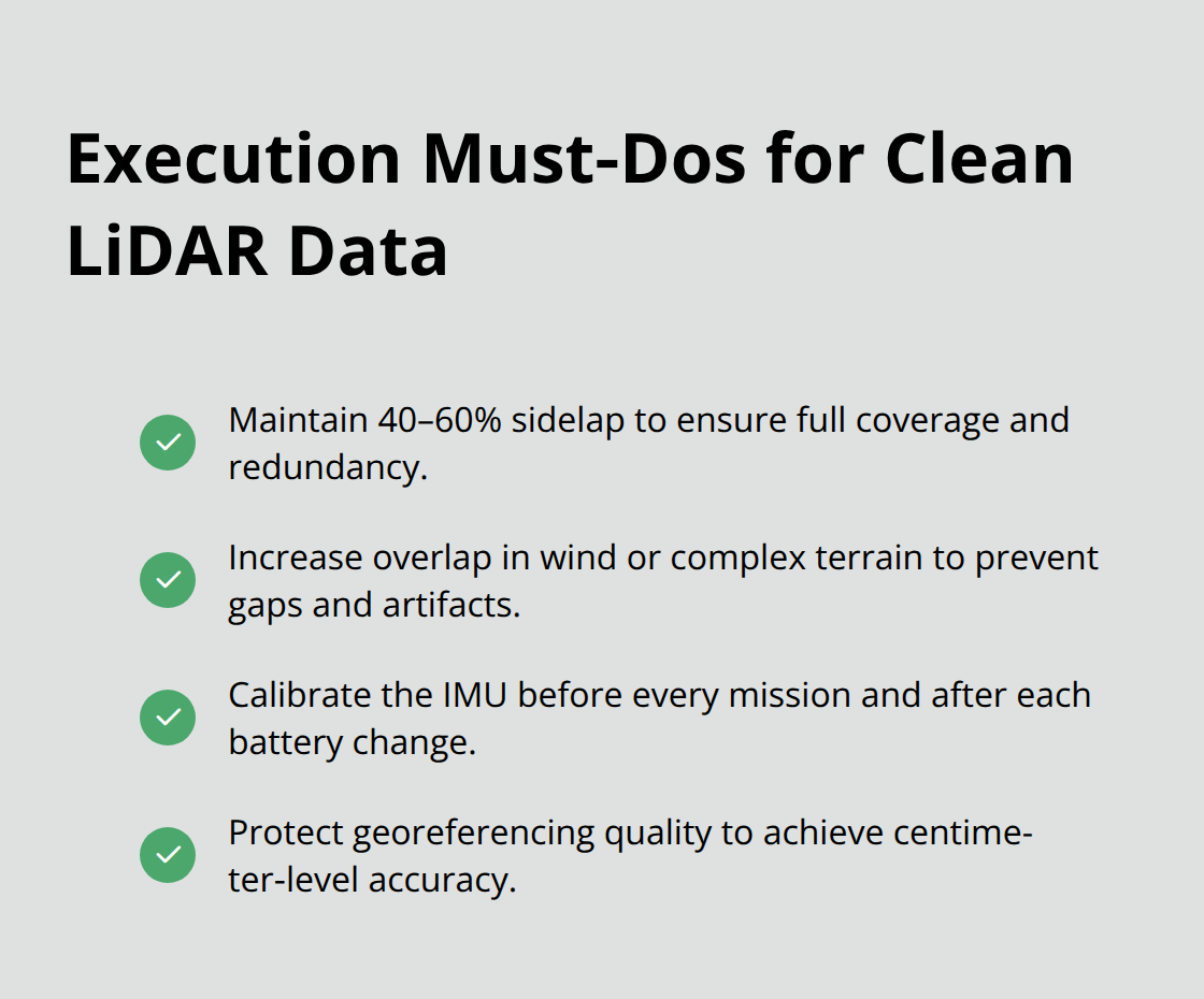
Data collection success hinges on maintaining consistent sidelap between flight lines and proper IMU calibration. Standard practice calls for 40 to 60 percent sidelap to ensure complete ground coverage and provide redundancy for processing. Higher overlap in challenging terrain or windy conditions prevents gaps that waste data and create processing artifacts. Perform IMU calibration before every mission and after battery changes, as this alignment determines whether your point cloud georeferencing achieves centimeter-level accuracy or drifts into error.
Plan for multiple batteries from the start: a single flight at 80 meters altitude covers 50 to 70 hectares for multirotor platforms like the DJI Matrice 350 RTK, meaning a 200-hectare site requires three to four batteries and 4 to 6 hours on site. Fixed-wing options extend coverage dramatically, with the Wingtra LiDAR system reaching 460 hectares per flight, but they require open space for takeoff and landing.
Validate Your Data With Ground Control Points
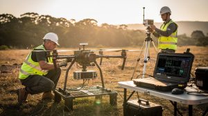
Collect ground control points before or during flights using survey-grade GPS equipment placed at site corners and interior locations. For sites under 50 hectares, four to six perimeter points plus one or two interior points provide adequate validation. Measure these points with centimeter-level accuracy and report root-mean-square error in your final deliverables to prove your work meets stated specifications.
Process and Deliver Accurate Results
Post-processing transforms raw data into usable models through classification, noise filtering, and validation. Export your point cloud to LAS format and transform it into your project coordinate system, then use specialized software to classify ground points separately from vegetation and structures. For a 50-hectare survey, expect 4 to 8 hours of processing time to produce clean, classified point clouds and digital elevation models. Validate your results against your ground control points to confirm accuracy before delivering anything to clients. This verification step catches processing errors early and protects your reputation.
Conclusion
Drone LiDAR mapping delivers measurable improvements in accuracy and safety that traditional surveying methods cannot match. The technology captures precise 3D data in conditions where cameras fail completely, penetrates dense vegetation to reveal ground elevation, and produces results in days rather than weeks. Organizations across construction, infrastructure, forestry, and environmental monitoring have adopted this approach because it reduces costs, accelerates project timelines, and eliminates dangerous fieldwork that exposes personnel to falls, electrical hazards, and confined spaces.
When your project requires ground elevation beneath tree cover, accurate terrain data in low-light conditions, or volumetric measurements that determine profitability, a drone with LiDAR mapping capabilities becomes the only practical choice. The technology has matured from experimental to standard practice, with proven workflows that deliver centimeter-level accuracy and validated results. Modern sensors like the DJI Zenmuse L2 achieve vertical accuracy within 4 centimeters at 80 meters altitude, and fixed-wing platforms extend coverage to hundreds of hectares per flight.
Success depends on proper planning before mobilization begins-define your deliverable first, determine the point density your project requires, and select flight altitude and line spacing accordingly. IE Drone Services brings FAA-certified expertise and proven equipment to deliver the accurate data your project demands, whether you need stockpile measurements, infrastructure inspection, or environmental monitoring. Contact us to discuss how drone LiDAR mapping can improve your next project.