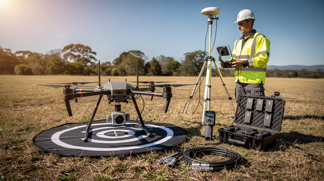
Elevation data shapes every major infrastructure project, from highway construction to environmental conservation. Drone elevation mapping has become the fastest way to capture precise terrain information across large areas.
At IE Drone Services, we’ve seen firsthand how this technology replaces outdated surveying methods that take weeks and cost thousands. This guide walks you through how elevation mapping works, where it delivers real value, and why it’s becoming standard practice across industries.
How Drones Measure Elevation
Two Core Technologies for Elevation Data
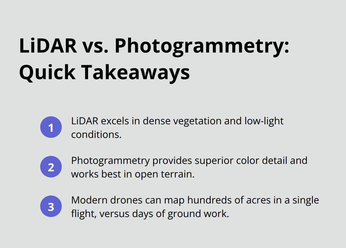
Drone elevation mapping relies on two primary technologies: LiDAR and photogrammetry. LiDAR systems emit laser pulses toward the ground and measure the time it takes for those pulses to return, creating a point cloud that represents the landscape in three dimensions. Photogrammetry works differently-it processes overlapping aerial images to calculate elevation by analyzing how objects appear from different angles.
The choice between these methods depends on your project requirements. LiDAR performs better in dense vegetation and poor lighting conditions, while photogrammetry delivers superior color information and works effectively in open terrain. Modern drone systems capture elevation data across hundreds of acres in a single flight, where traditional ground surveying would require days of fieldwork.
Accuracy Standards That Matter
Resolution and accuracy matter far more than raw speed. Most commercial drone systems achieve horizontal accuracy within 2 to 5 centimeters and vertical accuracy within 5 to 10 centimeters. This level of precision exceeds what many construction and infrastructure projects require-highway design typically needs vertical accuracy within 15 centimeters, meaning drone data provides a safety margin.
The resolution of elevation maps ranges from 2.5 centimeters per pixel for detailed site analysis to 30 centimeters for broad landscape assessment. Lower resolution captures work for regional planning, while higher resolution becomes necessary when tracking subtle grade changes or identifying drainage problems.
Environmental Factors That Affect Data Quality
Weather conditions significantly impact data quality. Overcast skies reduce photogrammetry accuracy, while rain and fog degrade LiDAR performance. Flight altitude also determines resolution; flying at 120 meters captures finer detail than 300 meters, though it requires more flight time.
These variables shape how professionals plan elevation mapping missions. The goal isn’t to fly the highest resolution possible-it’s to match your specific accuracy requirements with the right technology and flight parameters. Understanding these factors helps you select the right approach for infrastructure planning, environmental assessment, or construction site analysis.
Real-World Applications of Elevation Mapping
Infrastructure Design and Construction Planning
Highway and bridge projects depend on precise elevation models to calculate cut-and-fill volumes, which directly impact project budgets. Elevation mapping captures terrain at 5-centimeter vertical accuracy, eliminating the estimation errors that traditional survey methods produce. Design teams use this data to optimize grade lines, identify drainage patterns, and plan utility corridors without field delays. Infrastructure firms tackle sprawling project sites where traditional surveying would require months of ground-based work.
Environmental Monitoring and Conservation
Land managers track erosion patterns, stream channel migration, and vegetation encroachment by comparing elevation models captured months or years apart. Wetland restoration projects require baseline elevation data to understand current conditions before intervention work begins. Conservation organizations use drone elevation mapping to monitor hillside stability in areas prone to landslides, capturing data that informs evacuation decisions. This approach transforms how environmental teams assess landscape changes that would have taken weeks to document through manual methods.
Construction Progress Tracking and Quality Control
Contractors compare actual grade progress against design specifications using elevation models captured every few weeks. This method identifies compaction problems, drainage issues, or grading errors while crews can still correct them cost-effectively. Developers use elevation data to plan site layouts, optimize building placement, and demonstrate compliance with grading permits to local authorities. Projects that use elevation mapping for progress tracking report fewer change orders and faster completion timelines than those relying on manual grade checking.
Why Elevation Data Matters Across Industries
The financial impact matters most: elevation mapping eliminates guesswork and reduces rework costs across infrastructure, environmental, and construction sectors.
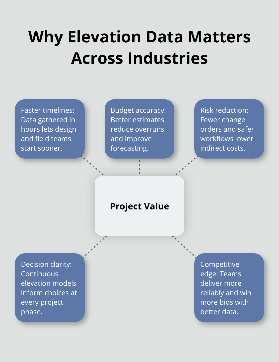
Organizations that adopt this technology gain competitive advantages through faster project timelines and more accurate budget forecasting. The practical value comes not from the technology itself, but from how elevation data transforms decision-making at every project phase. Understanding these applications reveals why elevation mapping has become standard practice-and why selecting the right service provider determines whether your project captures maximum value from this capability.
Why Drone Elevation Mapping Costs Less Than Traditional Surveying
Speed Cuts Survey Expenses in Half
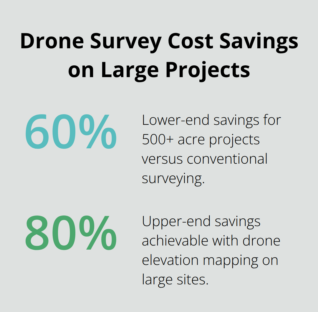
Traditional ground surveying requires crews to physically access every section of terrain, which means weeks of fieldwork for large sites. A typical manned survey crew costs between $2,000 and $5,000 per day and needs multiple days to map even modest project areas. Drone elevation mapping completes the same work in hours, not days, which translates to immediate cost reductions. Projects spanning 500 acres or larger see the most dramatic savings, often cutting survey costs by 60 to 80 percent compared to conventional methods.
The speed advantage matters just as much as the price: getting elevation data in one flight means design teams start their work sooner, which compresses overall project timelines and reduces indirect costs from extended site management.
Hazardous Terrain No Longer Requires Ground Crews
Safety transforms when teams stop sending workers into hazardous terrain. Traditional surveyors must navigate steep slopes, unstable embankments, active construction zones, and areas prone to rockfall or erosion. Drone operators capture the same data from a safe distance, which eliminates exposure to these hazards entirely. This safety shift has real financial consequences: fewer on-site personnel means lower insurance premiums and reduced liability exposure. Environmental monitoring projects benefit enormously because crews no longer need to hike through sensitive wetlands or fragile ecosystems where their presence causes damage. Construction sites with active equipment operation become measurably safer when elevation tracking happens from the air rather than on the ground.
Precision Prevents Costly Mistakes
Higher precision arrives as a direct benefit of drone technology. Ground surveys depend on individual measurements taken at scattered points, then interpolated to estimate elevations between those points. Drone systems capture continuous elevation data across entire sites, which reveals subtle grade changes that point-based methods miss. This precision prevents expensive mistakes: contractors discover compaction problems or drainage issues during early stages when corrections cost hundreds rather than thousands. Developers optimize building placement more effectively when they see exactly how terrain slopes rather than working from estimated contours. The detailed elevation models from drone flights provide actionable information that changes project decisions, making the technology an investment in better outcomes rather than simply a faster alternative to outdated methods.
Final Thoughts
Drone elevation mapping delivers measurable advantages that traditional surveying cannot match. The technology captures precise terrain data in hours instead of weeks, cuts survey costs by 60 to 80 percent on large projects, and eliminates the safety risks that come with sending crews into hazardous terrain. Infrastructure teams, environmental managers, and construction contractors now have access to continuous elevation data that reveals subtle grade changes and prevents costly mistakes before they happen.
Organizations that adopt drone elevation mapping gain competitive advantages through faster project timelines, more accurate budget forecasting, and better decision-making at every phase. The detailed elevation models from drone flights provide actionable information that transforms project outcomes, making the investment worthwhile regardless of project size. This technology works across diverse applications, from highway design to wetland restoration to progress tracking on active job sites.
If you manage infrastructure projects, environmental sites, or construction operations, contact IE Drone Services to discuss how drone technology can improve your next project. Our FAA-certified team understands how precise elevation data transforms project outcomes and can deliver data that matches your accuracy standards. We bring expertise in aerial data collection across the Inland Empire to help you capture the elevation information your project requires.