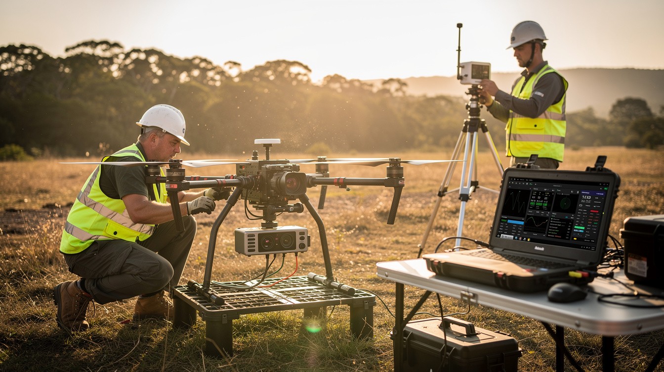
Mapping drones have become essential tools for professionals who need accurate, detailed data across industries. Whether you’re surveying land, inspecting infrastructure, or analyzing agricultural fields, selecting the right drone makes a real difference in project outcomes.
At IE Drone Services, we’ve worked with teams across multiple sectors, and we know that choosing between dozens of models can feel overwhelming. This guide breaks down the features that matter most and shows you which drones deliver real value for your specific work.
What Specs Actually Matter When Choosing a Mapping Drone
Camera Resolution and Sensor Size Set the Foundation
Camera resolution and sensor size form the foundation of any mapping platform, but raw megapixels tell only part of the story. A 20 MP camera with a 1-inch sensor will outperform a 48 MP camera with a smaller sensor in low-light conditions and when generating orthomosaics from video. The DJI Matrice 350 RTK carries a 45 MP payload option that handles large infrastructure surveys without sacrificing detail, while the DJI Mavic 3 Enterprise delivers 20 MP through a mechanical shutter that eliminates motion blur on fast flights. For video-based mapping workflows like those processed through SkyeBrowse, frame quality matters more than drone price-the software accepts standard MP4 or MOV files from nearly any drone, then uses telemetry data to georeference each frame. This means you can capture survey-grade results without purchasing the most expensive platform on the market.
Flight Time Determines Your Coverage Area
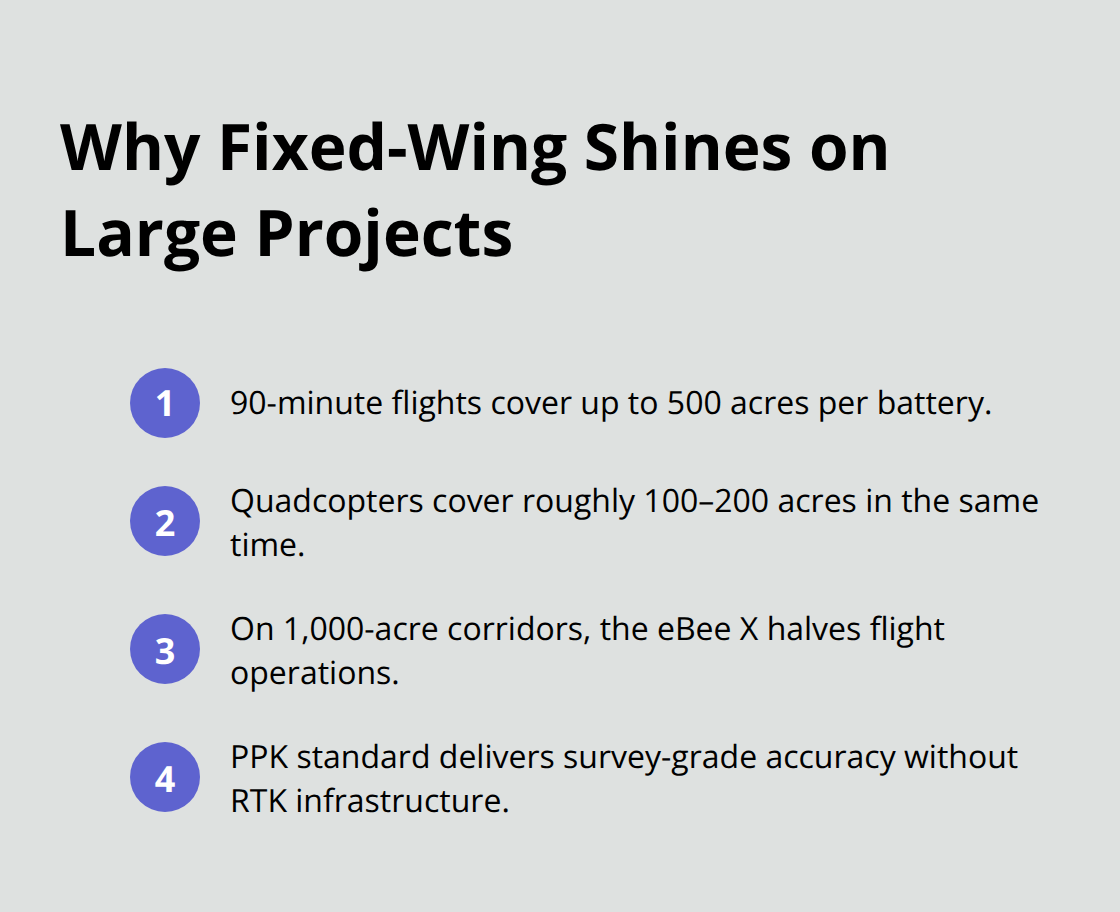
Most professional quadcopters deliver 35 to 55 minutes per battery, which translates to roughly 100 to 200 acres covered at 100 meters altitude with proper overlap settings. The senseFly eBee X, a fixed-wing platform, exceeds 90 minutes and covers 500 acres per flight-a massive advantage on large projects where battery swaps introduce delays and inconsistency. For sites under 200 acres, a Mavic 3 Enterprise or Phantom 4 RTK handles the work efficiently. For anything larger, fixed-wing platforms or hybrid VTOL systems become cost-effective because they reduce relaunches, ground crew time, and processing complexity.
RTK and PPK Accuracy Changes Your Workflow
Real-Time Kinematic GPS delivers 1 to 3 centimeter horizontal accuracy during flight without ground control points, enabling on-site decision-making and immediate visual feedback. Post-Processing Kinematic achieves similar accuracy but requires correction after flight. PPK is more resilient to signal dropouts because the entire observation file is available for post-processing, while RTK loses accuracy if the connection drops mid-flight. PPK supports baselines up to 100 kilometers, critical for large-area mapping like infrastructure corridors or forest surveys.
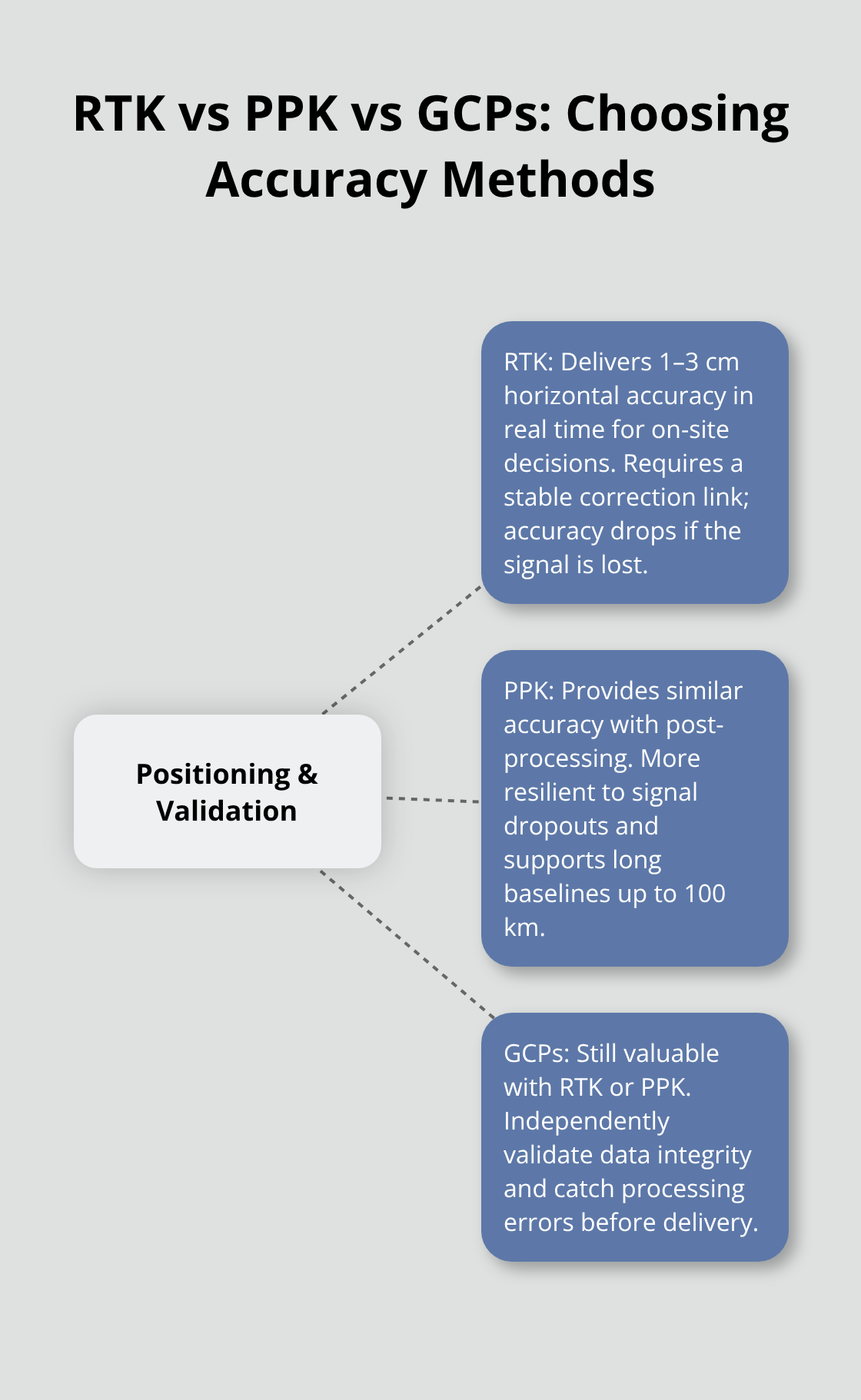
Choose RTK when you need speed and real-time data on-site; choose PPK when reliability and long-range capability matter more than instant results.
Matching Accuracy to Your Project Scale
The accuracy tier you select shapes both your timeline and your budget. RTK works best for smaller sites where you need immediate results and maintain stable connectivity to a correction source. PPK excels on large-scale projects where signal reliability matters more than instant feedback, and where you can wait one day for processed data. Ground control points remain valuable even with RTK or PPK-validating drone-derived data against GCPs helps confirm dataset integrity and catches processing errors before they affect your deliverables. For most professionals, pairing a solid sensor with the right positioning method (RTK or PPK) matters far more than spending extra on the highest-priced drone model available.
Which Drone Models Deliver Real Value for Professional Mapping
Enterprise-Grade Platforms for Large-Scale Projects
The DJI Matrice 350 RTK stands as the industry standard for large-scale surveying work, and for good reason. It delivers up to 55 minutes of flight time, carries payloads up to 45 MP for high-resolution imagery, and includes integrated RTK for centimeter-level accuracy without ground control points. At roughly $15,000 to $30,000, it costs more than entry-level platforms, but professionals working on infrastructure surveys, utility corridor mapping, or large construction sites recover that investment quickly through faster data collection and fewer battery swaps. The Matrice 350 RTK pairs exceptionally well with the Zenmuse L3 LiDAR payload, which senses up to 950 meters and delivers 3 centimeter ground sampling distance at 300 meters altitude. This combination handles dense vegetation, complex terrain, and low-light conditions where photogrammetry alone falls short. For teams focused on survey-grade accuracy across large areas, this pairing represents the most advanced professional solution available.
Portable Solutions for Rapid Deployment
The DJI Mavic 3 Enterprise occupies a different market position entirely. At $5,000 to $10,000, it costs roughly one-quarter of the Matrice 350 RTK but delivers 45 minutes of flight time and a 20 MP camera with mechanical shutter. This platform excels when you need rapid deployment, site documentation, public safety response, or building surveys on smaller projects. Its portability means one operator can move between multiple job sites in a single day-a massive practical advantage over heavier systems that require extended setup. The Phantom 4 RTK provides another strong option for professionals on tighter budgets, offering 30 minutes of flight time, 20 MP resolution, and integrated RTK for roughly $5,000 to $8,000. For sites under 200 acres, this drone handles topographic surveys and land measurement work without compromise on accuracy.
Fixed-Wing Platforms for Maximum Coverage
Fixed-wing platforms like the senseFly eBee X reshape economics on large projects. At roughly $25,000 and above, it seems expensive until you examine the numbers: 90 minutes of flight time covers up to 500 acres per battery, compared to 100 to 200 acres for quadcopters in the same timeframe. On a 1,000-acre infrastructure corridor or agricultural survey, the eBee X cuts flight operations in half, reducing labor, coordination complexity, and processing inconsistency. Post-Processing Kinematic comes standard with senseFly platforms, enabling survey-grade accuracy without RTK infrastructure.
Software Integration Outperforms Hardware Cost
Software integration matters as much as hardware specs. SkyeBrowse videogrammetry accepts standard MP4 or MOV video from nearly any drone and processes it in the cloud using telemetry data from the flight. An independent accuracy study by AirBorne Works found SkyeBrowse video models matched Leica BLK360 laser-scan ground truth more closely than Pix4D Mapper on eight of nine measurements, proving that processing quality and telemetry integration can outperform raw hardware cost. This workflow means professionals can use a Mavic 3 Enterprise, capture video on the flight, upload telemetry via Wi-Fi, and receive orthomosaics and 3D point clouds within one day without purchasing desktop software licenses.
Matching Budget to Project Requirements
A $3,500 Autel EVO II Pro with strong video processing often outperforms a $15,000 drone paired with poor software choices. Match your drone to project scope and budget, then invest heavily in software that maximizes data quality and processing speed. The right combination of hardware and processing tools determines whether your team captures actionable data efficiently or wastes resources on platforms that don’t fit your workflow. Once you’ve selected your drone and software stack, the next step involves understanding how different industries apply these tools to solve real problems.
Applications of Mapping Drones Across Industries
Surveying and Land Measurement
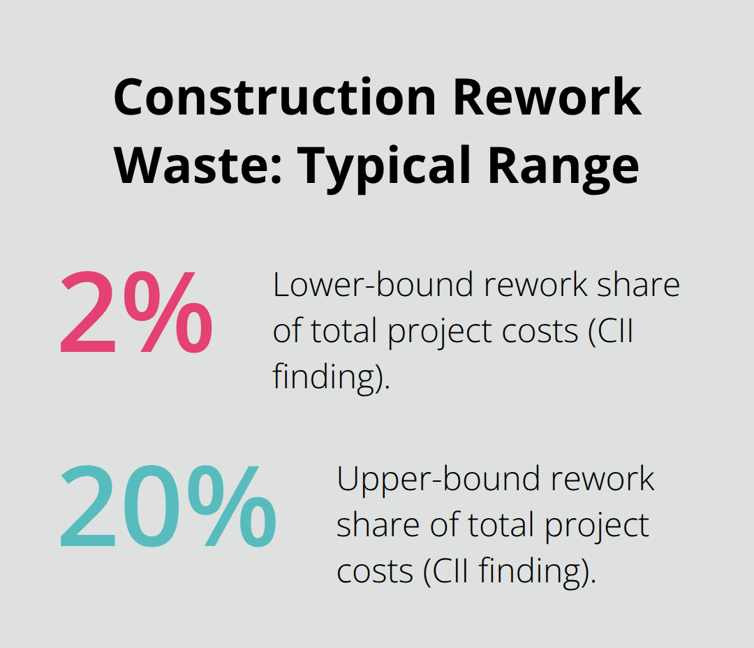
Professional mapping drones replace traditional rover surveys that consume entire days or weeks on foot. A Phantom 4 RTK or Mavic 3 Enterprise collects survey-grade topographic data in under an hour, delivering 1:500 scale maps with centimeter-level accuracy and eliminating the need for extensive ground control points. The Construction Industry Institute found that rework costs range from 2 to 20 percent of total project costs, and frequent drone surveys cut that waste significantly by catching discrepancies between design and as-built conditions before problems cascade.
Orthophotos and dense point clouds from photogrammetry enable precise volume calculations for stockpiles, trenching, and slope gradients-critical data for bid accuracy and progress verification.
A Global Construction Disputes Report by Arcadis highlighted poor record keeping as a leading cause of disputes in North America; drone data creates auditable, time-stamped site records that eliminate ambiguity when change orders or schedule delays arise. For large infrastructure projects, a fixed-wing platform like the senseFly eBee X reduces field operations significantly because it covers 500 acres per flight instead of 100 to 200 acres, meaning fewer battery swaps and more consistent data across the entire survey area.
Infrastructure Inspection and Monitoring
Drones enable safer site exploration by inspecting hazardous areas-utility corridors, bridge decks, roof systems, and slope conditions-from the air, reducing worker exposure to risk. Speed and precision that manual climbing or scaffolding cannot match become standard with aerial platforms. The Matrice 350 RTK paired with the Zenmuse L3 LiDAR payload handles complex terrain and dense vegetation where photogrammetry fails, detecting features up to 950 meters away with 3 centimeter ground sampling distance at 300 meters altitude. This combination excels at utility corridor mapping and environmental monitoring across large areas.
Real-time 2D orthomosaics enable immediate visualization of land cover and changes in the field, supporting faster decision-making on site conditions and maintenance priorities. Teams can assess structural integrity, detect erosion patterns, and identify vegetation encroachment without waiting for post-processing results.
Agricultural Crop Analysis and Precision Management
Agricultural crop analysis demands multispectral sensing to track vegetation health and yield potential across entire fields. The Phantom 4 Multispectral captures green, red, red edge, and infrared bands simultaneously, generating vegetation index maps that identify stress and disease before visible symptoms appear-enabling targeted intervention instead of field-wide treatment. The Mavic 3 Multispectral extends flight autonomy even further, covering larger fields without battery swaps.
Cloud-based platforms unify flight plans, imagery, and team communication, enabling real-time sharing between field and office to accelerate decision-making and reduce delays. Latest drone survey data typically becomes available one day after flight, fast enough to guide irrigation decisions, pesticide application, or harvest timing. Each industry demands different sensor combinations and accuracy thresholds; the goal involves matching the right platform and workflow to your specific measurement requirements and timeline.
Final Thoughts
Selecting the right mapping drone depends on three core factors: your project scale, accuracy requirements, and budget constraints. A Phantom 4 RTK works efficiently for surveys under 200 acres where centimeter-level accuracy matters and rapid deployment is essential. The Matrice 350 RTK becomes the logical choice for infrastructure projects spanning thousands of acres or requiring LiDAR payloads to penetrate dense vegetation, while fixed-wing platforms like the senseFly eBee X reshape project economics on large-area work by cutting flight operations in half compared to quadcopters.
Your project needs should drive platform selection, not the other way around. A construction team documenting site progress benefits from the Mavic 3 Enterprise’s portability and 45-minute flight time, while an agricultural operation tracking crop health across multiple fields needs multispectral sensors and cloud-based processing to act on data within hours. An infrastructure company inspecting utility corridors spanning hundreds of miles requires fixed-wing endurance and PPK accuracy to handle remote areas without connectivity constraints, and ground control points remain valuable validation tools even with RTK or PPK to confirm dataset integrity before delivery to stakeholders.
Define your measurement requirements first-what accuracy you need, how large your survey area is, and what timeline works for your workflow. Match those requirements to a platform that fits your budget without overspending on unnecessary features, then invest in processing software and workflows that maximize data quality from whatever mapping drone you select. Contact IE Drone Services to discuss your specific project needs and find the right platform and workflow for your operation.