Property inspections in the Inland Empire have traditionally meant sending workers up ladders, across roofs, and into tight spaces. That approach wastes time, puts people at risk, and often misses critical details.
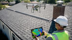
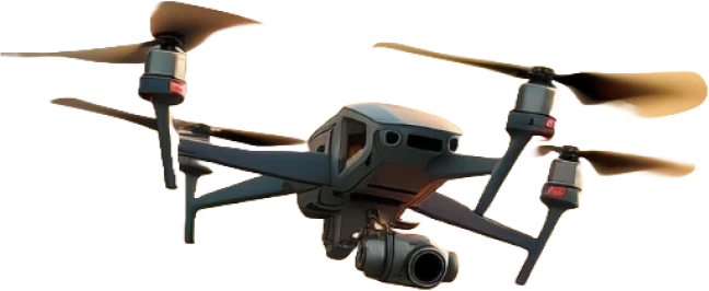
Inland Empire drone inspections change that equation entirely. We at IE Drone Services use certified aerial technology to assess roofs, solar panels, and building conditions with precision and speed that ground-based methods simply cannot match.
Why Drone Inspections Save Time and Money in the Inland Empire
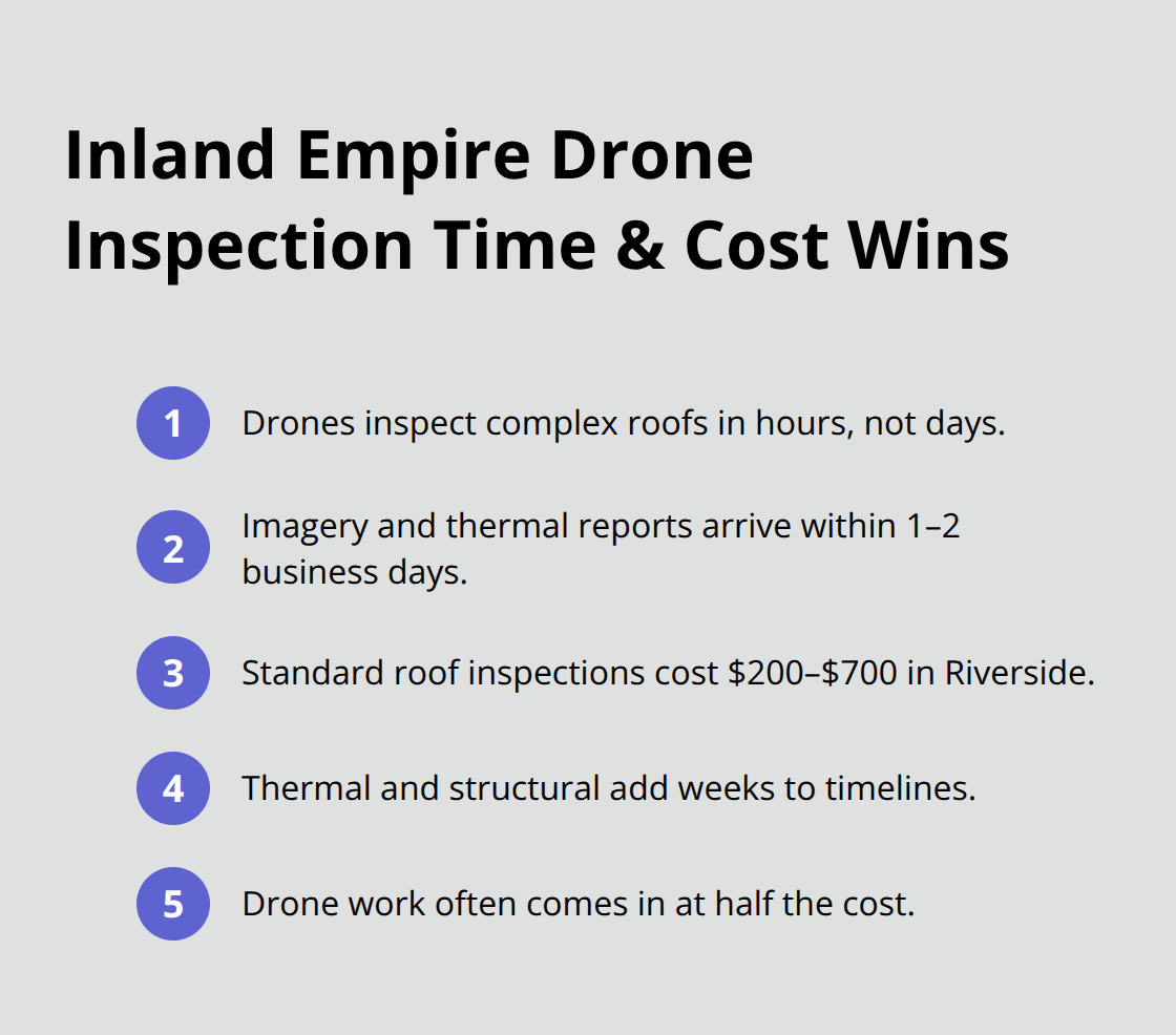
Traditional roof and building inspections in the Inland Empire follow a predictable and expensive pattern. Property managers schedule workers weeks in advance, rent scaffolding or lifts, and pay for multiple days of labor to assess what a drone can inspect in hours. Standard roof inspections in Riverside typically cost between $200 and $700 and take 1–2 days, while thermal analysis and structural assessments add weeks to project timelines. Drone inspections compress that process dramatically. High-resolution imagery and thermal data arrive within 1–2 business days, often at half the cost of traditional methods.
For industrial properties across the Inland Empire’s logistics boom along I-215 and Highway 60, that speed translates directly to faster decision-making on maintenance, repairs, or asset valuations. A property owner who avoids even one week of scaffolding rental saves thousands in equipment costs alone.
Safety eliminates ground-based risk
The safety argument for aerial inspections is straightforward and non-negotiable. Workers no longer climb ladders, traverse steep roofs, or work from elevated platforms where falls remain a leading cause of workplace injuries. OSHA data on fall-related workplace fatalities shows that workers face significant risk on rooftops, yet many property managers still rely on traditional methods out of habit rather than necessity. Drone inspections keep personnel on the ground where they belong, eliminating exposure to weather, heights, and structural hazards. For solar panel installations becoming increasingly common in Riverside’s industrial parks, thermal cameras identify performance issues and equipment failures without putting technicians at risk on rooftops. Facilities managers in the Inland Empire reduce liability exposure, lower workers’ compensation claims, and demonstrate genuine commitment to employee safety-all while gathering more accurate data than ground-based visual inspections could ever provide.
Thermal imaging reveals what eyes cannot see
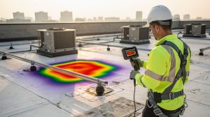
High-resolution thermal cameras detect energy leaks, moisture intrusion, and equipment failures that standard photography completely misses. A building with poor insulation or failing HVAC systems shows up instantly in thermal data, giving property owners concrete evidence for repair prioritization and budget allocation. For the Inland Empire’s expanding warehouse and logistics sector, thermal inspections identify heat loss in massive structures, helping managers reduce cooling costs and extend equipment life. The data arrives in formats that integrate directly into maintenance schedules and capital planning, turning abstract observations into actionable intelligence that drives real operational improvements.
Accurate data accelerates your next decision
Property owners across the Inland Empire face constant pressure to make fast, informed choices about maintenance budgets and capital investments. Drone inspections provide the precise imagery and thermal readings needed to prioritize work orders and justify expenditures to stakeholders. When you have high-resolution visual documentation and thermal analysis in hand (rather than relying on a technician’s written notes), you eliminate guesswork and reduce the risk of costly mistakes. Industrial facilities, commercial real estate portfolios, and solar installations all benefit from this level of data accuracy. The faster you access reliable information, the sooner you can act on it-whether that means scheduling repairs, adjusting energy systems, or moving forward with property transactions.
What Drone Cameras Actually See on Your Property
High-Resolution Imagery Reveals Hidden Roof Defects
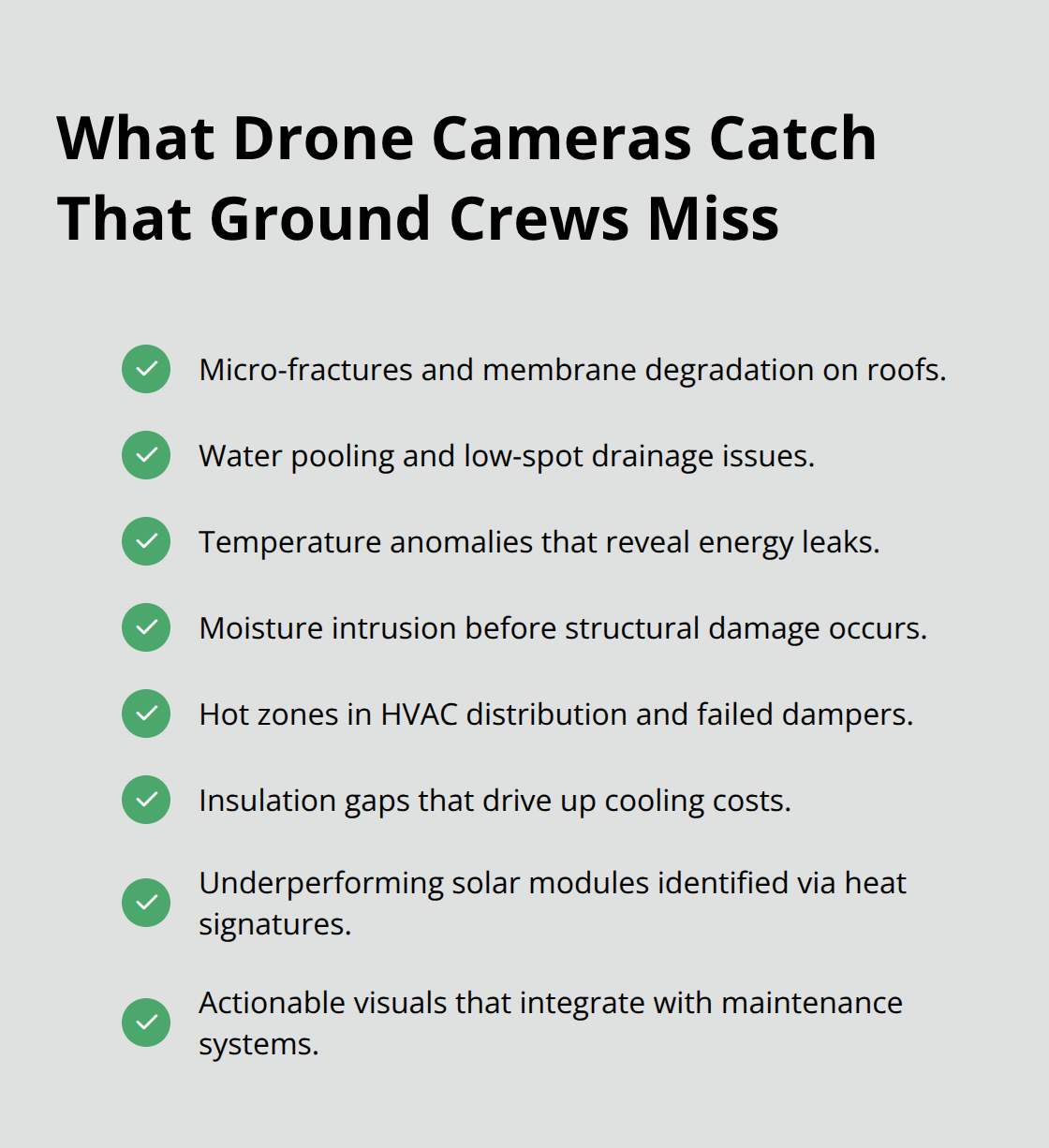
Standard roof inspections from the ground miss micro-fractures, membrane degradation, and water pooling in low spots. Aerial platforms capture these issues at high resolution, making every defect visible enough to measure and prioritize. For Riverside properties, drone roof inspections complete surveys faster with better defect detection and audit-ready records. The imagery integrates directly into maintenance management systems, eliminating follow-up site visits to confirm problems or assess repair scope.
Industrial facilities along I-215 benefit particularly because logistics warehouses feature complex roof systems with multiple HVAC penetrations, skylights, and membrane sections that demand thorough assessment.
Thermal Cameras Detect Energy Loss Before Damage Occurs
Infrared cameras operate on a fundamentally different principle than visible-light photography. They detect temperature variations across building surfaces, revealing where heating or cooling escapes and where moisture accumulates before structural damage takes hold. Solar panel installations show immediate performance degradation through thermal data-a malfunctioning module generates excess heat and appears distinctly different from functioning panels, allowing technicians to isolate defective equipment without testing every connection. For commercial properties with significant cooling loads, thermal inspections identify hot zones in HVAC distribution, failed dampers, and insulation gaps that waste thousands annually. The cost advantage compounds across multiple inspections-thermal roof assessments in Riverside range from $200 to $700 depending on property size, while a single thermal scan often prevents costly emergency repairs by catching problems at early stages.
Actionable Data Transforms Property Management Decisions
When property managers receive thermal reports showing precise temperature readings and heat loss zones mapped across their building, they make faster decisions about capital allocation. Concrete visual evidence replaces speculation, allowing managers to justify renovation budgets to ownership with confidence. Industrial facilities, commercial real estate portfolios, and solar installations all benefit from this level of data accuracy. The faster you access reliable information, the sooner you can act on it-whether that means scheduling repairs, adjusting energy systems, or moving forward with property transactions. This precision in data collection sets the foundation for understanding exactly which inspection services your property needs and how to prioritize them.
What Every Inland Empire Property Owner Needs to Know About Drone Inspection Regulations
Federal Certification and Airspace Authorization
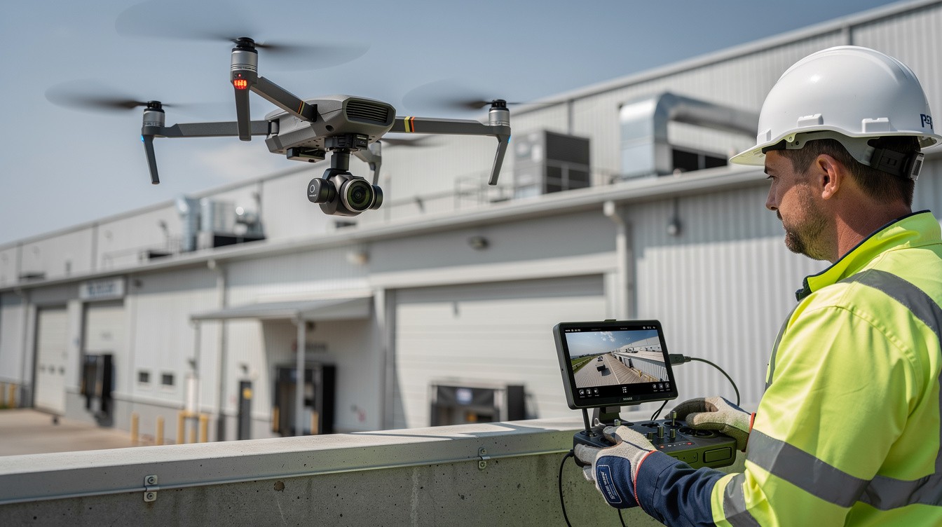
Commercial drone operations in the Inland Empire operate under federal aviation rules that exist for good reason. The FAA Part 107 Remote Pilot Certificate demonstrates that operators understand the regulations, operating requirements, and procedures for safely flying drones, and this certification requires passing a knowledge exam covering airspace regulations, weather limitations, and operational safety. Property owners who hire uncertified operators expose themselves to federal penalties and liability claims that dwarf the cost savings from cutting corners.

The Inland Empire presents specific airspace challenges that demand expertise. March Air Reserve Base creates Class C airspace extending five nautical miles at up to 4,000 feet above ground level, while Riverside Municipal Airport imposes Class D restrictions within four nautical miles, and Ontario International Airport’s Class C airspace reaches roughly 15 miles west of the city. Every commercial flight in these zones requires LAANC authorization, which automates the application and approval process for airspace authorizations.
Protected Areas and Environmental Restrictions
Lake Mathews Ecological Reserve prohibits drone operations entirely per California Department of Fish and Wildlife regulations, and Box Springs Mountains Reserve and Sycamore Canyon Wilderness Park require advance permits from Riverside County Parks. Water treatment facilities and reservoirs fall under California AB 527 critical infrastructure designation, meaning drone flights over these sites demand operator consent and additional coordination. The City of Riverside itself mandates commercial permits for takeoffs and landings on city-owned property, though private property operations still require full FAA Part 107 compliance. Operators who understand these layers of regulation move forward confidently rather than discovering mid-project that their flight plan violates airspace restrictions or environmental protections.
Insurance and Professional Accountability
Insurance and liability coverage separate professional drone operators from hobbyists operating in gray legal territory. Commercial liability policies specifically covering drone operations protect property owners against damage claims, and reputable operators carry coverage that names clients as additional insureds. Operators unfamiliar with Inland Empire airspace restrictions or lacking proper insurance create unnecessary risk and delays.
Operational Safety and Data Quality Standards
Weather conditions in the Inland Empire shift rapidly, and wind speeds above 20 miles per hour compromise image quality and flight stability, making early-morning or late-afternoon flights preferable to midday operations when thermal updrafts intensify. Ground personnel must maintain clear communication with the remote pilot, establish exclusion zones to keep bystanders away from the aircraft, and verify that the property owner has authority to grant flight permission.
Thermal inspections specifically demand calibration verification before flights to ensure temperature readings meet accuracy standards, and high-resolution imagery requires sufficient lighting to capture defect details that justify the inspection cost. These operational details separate inspections that deliver actionable data from flights that generate images without meaningful insight. When you work with operators who understand these requirements, your inspection proceeds on schedule without regulatory delays or compromised results.
Final Thoughts
Inland Empire drone inspections deliver results that traditional methods cannot match. You receive high-resolution imagery and thermal data within 1–2 business days instead of waiting weeks for scaffolding setup and multiple site visits. The cost difference is substantial-drone assessments often run half the price of conventional inspections while eliminating equipment rentals, labor delays, and worker safety risks.
Choosing the right provider matters enormously in the Inland Empire’s complex airspace environment. March Air Reserve Base, Riverside Municipal Airport, and Ontario International Airport create overlapping Class C and Class D restrictions that demand expertise. Environmental protections at Lake Mathews Ecological Reserve and water treatment facilities under California AB 527 add another layer of compliance requirements that a certified operator navigates without delays.
Contact IE Drone Services to discuss your property’s inspection needs, whether that involves roof condition assessment, solar panel performance evaluation, or thermal energy leak detection. We schedule flights around your operational timeline, deliver results quickly, and provide documentation that integrates directly into your maintenance and capital planning systems. The sooner you access accurate aerial data, the sooner you act on it.