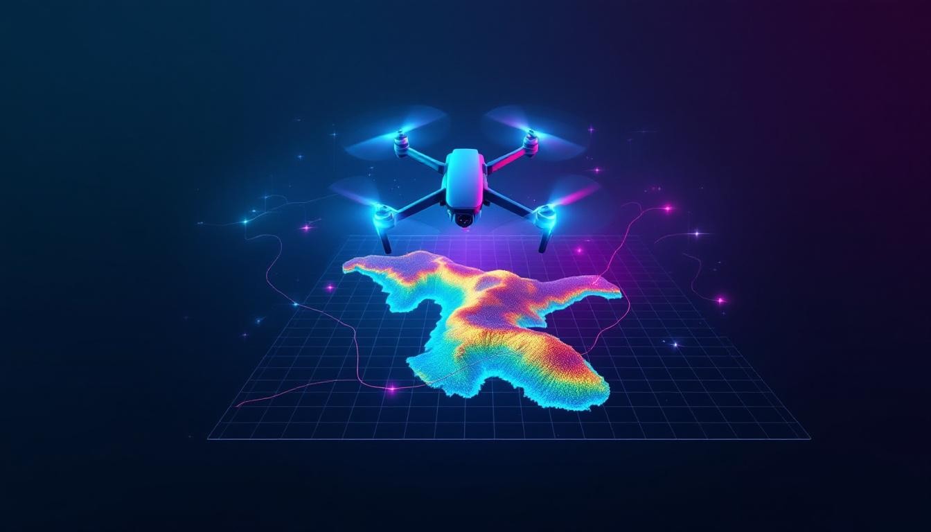
Mapping and surveying have changed dramatically over the past decade. Drones now deliver what used to take weeks in just days, with accuracy that rivals traditional methods at a fraction of the cost.
At IE Drone Services, we’ve seen firsthand how drone mapping and surveying technology transforms projects across construction, agriculture, and real estate. This guide walks you through the capabilities, applications, and real advantages that make drones indispensable for modern surveying work.
How Drones Outpace Traditional Surveying Methods
Drone surveys complete in days what traditional crews need weeks to finish. A fixed-wing VTOL drone with a 61 MP camera maps over 1,100 acres in a single flight, according to WingtraOne Gen II specifications. Ground-based crews covering the same area require multiple site visits, weather delays, and weeks of field measurements. Data collection and processing happen up to 10 times faster when you use drone workflows instead of conventional methods. This speed advantage matters most on active construction sites where project timelines are tight and delays cost money.
The Real Cost Savings in Your Budget
A basic drone mapping setup costs around $9,000-roughly $4,000 for the drone and $5,000 for mapping software like Pix4D or DroneDeploy. Most surveying operations see return on investment within two to three projects for small-area contour tasks. That breaks down to per-project costs that undercut traditional aerial photography from manned aircraft, which historically ran thousands of dollars per flight. Large construction firms using drones for volumetric measurements report improved billing accuracy and reduced labor hours spent on site assessments. When you factor in crew travel time, equipment rental, and extended project schedules, drone surveying cuts overall expenses significantly. The cost advantage grows with project size-larger sites benefit most from the reduced per-acre data collection expense.
Reaching Areas Ground Crews Cannot Access Safely
Steep terrain, dense vegetation, and hazardous environments create real risks for field surveyors on foot. Drones eliminate exposure to unstable ground, falling debris, and extreme weather while you capture equally precise data. LiDAR-equipped drones penetrate vegetation to measure ground elevation beneath tree canopy, which ground-based methods cannot do without cutting sight lines. Thermal cameras detect roof damage, power line issues, and structural problems from the air without requiring crew access to rooftops or electrical infrastructure. Stockpile volume measurements from a top-down perspective give accurate inventory data without surveyors climbing onto unstable material piles (a significant safety concern on active sites).
How Accuracy Translates to Better Project Outcomes
Drone surveys produce measurements that match or exceed traditional methods in precision. RTK and PPK systems deliver centimeter-level accuracy, which means your teams trust the data for critical decisions. High-resolution RGB sensors at 20 MP and above capture finer details that improve map quality and post-processing reliability. When you process hundreds of overlapping images through photogrammetry software, you generate thousands of measurement points that form precise 3D models and orthomosaics. This level of detail supports everything from construction progress tracking to property boundary verification without requiring additional field surveys.
The combination of speed, cost savings, and safety makes drone surveying the practical choice for modern projects. What remains is understanding which technical capabilities and equipment match your specific surveying needs-and how to select the right platform for your next project.
Applications of Drone Mapping and Surveying
Construction Site Monitoring and Progress Tracking
Construction teams deploy drones to track progress on active sites with measurable accuracy. Weekly drone flights capture the exact state of grading, foundation work, and structural progress without halting operations. Volumetric measurements from drone surveys show stockpile quantities within days instead of weeks, and contractors use this data to optimize material delivery and improve billing precision. A top-down perspective reveals details that ground-level photos miss-equipment placement, safety compliance, and work sequence issues become visible in orthomosaics and 3D models. Progress monitoring with drones cuts the time site managers spend on foot inspections by 60 to 80 percent, allowing them to focus on decision-making rather than data collection. Construction firms that implement drone monitoring report faster project completion and reduced disputes over payment milestones because visual evidence is documented consistently.
Agricultural Field Analysis and Crop Management
Agricultural operations benefit from drone data that guides resource allocation and identifies crop stress before it spreads. NDVI-based crop health monitoring reveals vegetation index variations across fields, showing exactly where irrigation, fertilizer, or pest management needs attention. Stand counts from high-resolution imagery help growers assess plant population and adjust seeding strategies for next season. Precision irrigation mapping generated from drone surveys reduces water waste by targeting application to areas that need it most.
Real Estate Property Assessment and Energy Efficiency
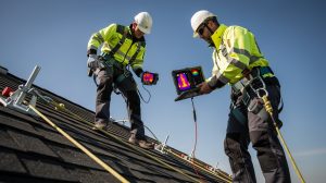
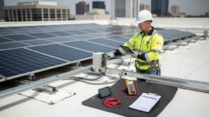
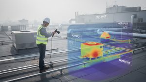
Real estate professionals use drone imagery and thermal data to showcase properties with compelling aerial views and to identify energy inefficiencies that affect property value. Thermal inspections reveal insulation gaps, roof leaks, and HVAC performance issues that standard photography cannot show, giving buyers and sellers concrete data for pricing and negotiation. Drone mapping techniques and best practices support thermal building and roof inspections using infrared cameras to detect energy leaks and structural problems from the air, eliminating the need for crews to access hazardous rooftops. This approach delivers faster, safer data collection than traditional methods.
Choosing the Right Drone Service for Your Industry
Whether you need construction progress documentation, agricultural field analysis, or property condition assessment, drone-based surveying delivers actionable intelligence that drives measurable improvements across your operations. The technical capabilities that support these applications-high-resolution imaging, thermal sensors, and precision positioning-determine how accurately your team can extract value from aerial data. Understanding which equipment and processing methods match your project requirements helps you select the right partner and maximize your return on investment.
Technical Capabilities and Data Accuracy
High-Resolution Imaging and LiDAR Technology
High-resolution RGB cameras with 20 MP and above capture the detail that matters for photogrammetry-the process that converts overlapping images into precise 3D models and orthomosaics. A 20 MP sensor produces measurable improvements in map quality compared to lower-resolution alternatives, particularly when you need to extract fine details for construction verification or property assessment. LiDAR sensors add a fundamentally different capability: they measure distances with laser light rather than relying on image analysis, which means they penetrate vegetation and capture ground elevation beneath tree canopy where photogrammetry fails. The WingtraOne Gen II combines a 42 MP camera with fixed-wing efficiency to map over 1,100 acres in a single flight, demonstrating how sensor quality and platform design work together to maximize coverage. For sites with dense vegetation or complex terrain, LiDAR becomes non-negotiable because it delivers accurate elevation data where traditional photography cannot.
Precision Positioning Systems
RTK and PPK positioning systems improve GNSS accuracy to the centimeter level, anchoring your imagery to real-world coordinates with precision that eliminates the need for extensive ground control point installation and saves time and expense on every project. The DJI Mavic 3 Enterprise integrates a 20 MP mechanical shutter camera with RTK positioning and delivers approximately 45 minutes of flight time, making it practical for rapid deployment on construction sites or property inspections where setup time must stay minimal. Mechanical shutters eliminate motion blur that compromises photogrammetry accuracy, so they represent a genuine technical requirement rather than a luxury feature when your work demands millimeter-level precision.
Data Processing and Deliverables
Data processing software transforms raw imagery and sensor measurements into deliverables your team can actually use. Pix4D, DroneDeploy, and DJI Terra are industry standards because they automate the conversion of hundreds of overlapping photos into orthomosaics, 3D models, and point clouds that integrate directly into CAD and GIS workflows. Real-time 2D orthomosaic visualization lets your team make immediate decisions on active sites without waiting for post-processing to complete, while high-resolution outputs from overnight processing support detailed analysis and volume calculations.
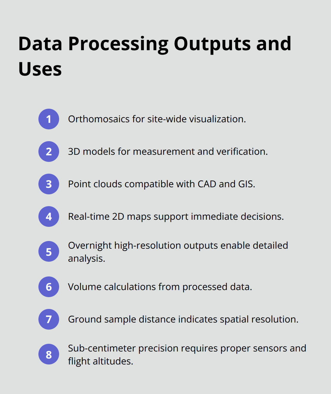
Ground sample distance quantifies spatial resolution in your final products-smaller values mean finer detail and more accurate measurements, and achieving sub-centimeter precision requires both high-resolution sensors and appropriate flight altitudes.
Selecting Equipment for Your Project Requirements
For construction progress tracking, you need orthomosaics and 3D models that update weekly or daily, which means selecting equipment and software that your team can operate without specialized expertise. The equipment selection process should prioritize which deliverables matter most for your specific use case-whether that means volumetric stockpile measurements, thermal building inspections, or high-resolution property documentation-because the right platform balances sensor capability, flight endurance, and processing workflow efficiency to deliver measurable value within your project timeline and budget constraints.
Final Thoughts
Drone technology for mapping and surveying delivers measurable advantages that traditional methods cannot match. Speed, cost efficiency, and safety improvements compound across every project type, from construction sites to agricultural operations to property assessments. The technical capabilities-high-resolution imaging, LiDAR penetration, RTK precision, and automated data processing-translate directly into actionable intelligence that drives better decisions and faster project completion.
Professional drone services handle the complexity of equipment selection, regulatory compliance, and data processing so your team focuses on results rather than logistics. FAA certification, mission planning expertise, and integration with industry-standard software platforms separate competent operators from those who simply fly equipment. The right partner understands your specific deliverables, selects appropriate sensors and flight strategies, and processes data into formats your existing workflows can use immediately (without compatibility delays or rework).
We at IE Drone Services operate FAA-certified platforms with high-resolution and thermal cameras across the Inland Empire, delivering thermal building and roof inspections, aerial photography, and precision data collection that improves property efficiency and supports real-estate marketing. Contact IE Drone Services to discuss your specific requirements and receive a proposal that outlines equipment, timeline, and deliverables for your next drone for mapping and surveying project.