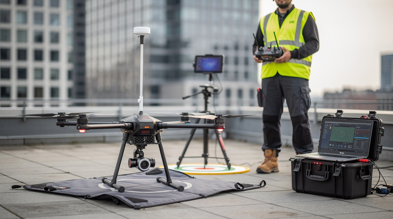
Drone mapping technology is transforming how Los Angeles businesses collect and analyze geographic data. From construction sites to infrastructure inspections, aerial imaging delivers precise measurements in hours instead of days.
At IE Drone Services, we’ve seen firsthand how drone mapping Los Angeles projects saves companies money while improving safety and accuracy. This guide walks you through the technology, its benefits, and why professional expertise matters for your next project.
How Drone Mapping Captures Precise Data
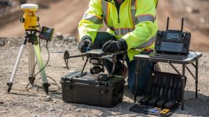
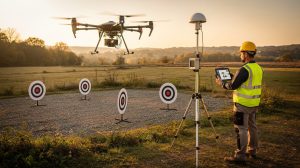
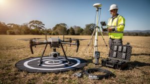
Drone mapping works by flying a camera-equipped aircraft over a site on a pre-planned GPS path. The drone records hundreds or thousands of overlapping images from above, each tagged with precise location data. Specialized software then stitches these images together using structure-from-motion photogrammetry, converting raw aerial photos into georeferenced maps and 3D models with centimeter-level accuracy.
The overlap between frames is what makes this process work. Flights typically maintain 75 to 85 percent image overlap between consecutive shots, allowing the software to identify matching points across images and calculate exact distances and elevations. A typical mapping mission over a 10-acre site takes two to four hours of flight time, depending on weather and terrain. The entire project from data capture to final deliverables usually completes within three to five business days-a timeline that matters for Los Angeles construction projects where delays cost thousands per day.
Sensors That Reveal What Cameras Miss
Standard RGB cameras capture the visual imagery you see in orthomosaic maps, but professional mapping also relies on infrared sensors and LiDAR to reveal information that regular cameras cannot detect. Infrared thermal cameras identify heat signatures, making them invaluable for solar panel inspections, roof condition assessment, and identifying energy leaks in buildings. This capability proves critical for Los Angeles property owners planning solar installations or energy upgrades.
LiDAR sensors capture precise measurements of distances and elevations, generating dense point clouds that reveal terrain detail even under tree canopy or in complex urban environments where shadows confuse camera-based methods. The choice of sensor directly impacts deliverable quality and project cost, so specifying your actual needs upfront prevents unnecessary expense and ensures you receive actionable outputs.
Converting Images Into Measurable Outputs
Post-processing transforms aerial images into formats your team actually uses. Orthomosaic maps correct lens distortion and perspective tilt, producing a bird’s-eye view where every pixel represents a true ground distance. This accuracy allows contractors to measure roof areas or verify stockpile volumes within inches of actual values.
Digital Surface Models show elevation across the entire site, including buildings and vegetation. Digital Elevation Models reveal bare earth terrain for grading and drainage analysis. CAD-ready 3D models and point clouds integrate directly into design software like AutoCAD or Revit, eliminating manual data entry and reducing errors.
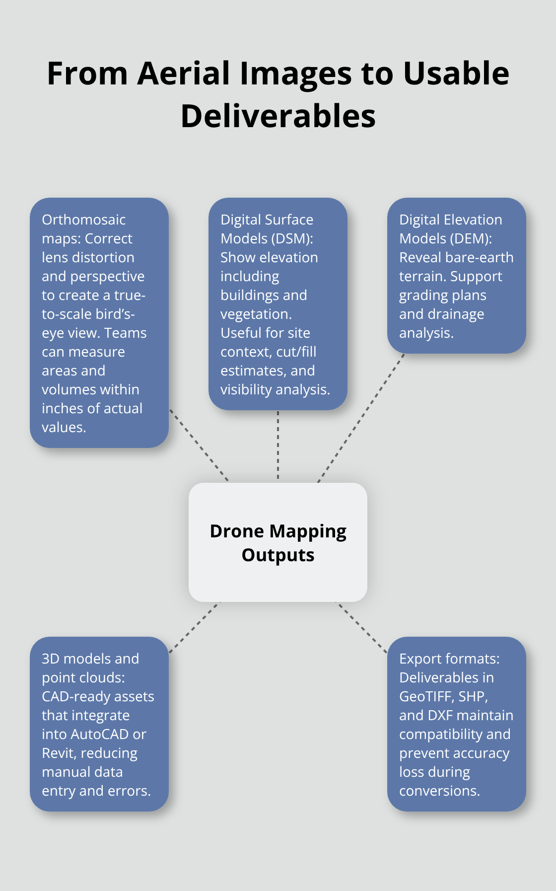
Export formats matter significantly for workflow compatibility. Requesting outputs in GeoTIFF, SHP, or DXF ensures your existing systems accept the data rather than forcing a conversion step that introduces inaccuracy. Most mapping projects in Los Angeles benefit from orthomosaics for measurement and progress tracking, combined with 3D models for design visualization and as-built verification against original plans.
Selecting the Right Equipment for Your Project
The drone platform you choose determines what data you can collect and how quickly you can deliver results. Professional-grade platforms support high-resolution RGB sensors, thermal cameras, and LiDAR payloads (depending on the model), allowing operators to capture multiple data types in a single flight. This multi-sensor approach reduces mission time and costs compared to flying separate flights for different data types.
Weather conditions and site characteristics also influence equipment selection. Urban environments with tall buildings require drones that handle wind and provide stable hovering, while large open areas benefit from platforms with extended flight times. Terrain complexity-whether your site includes dense vegetation, water, or steep slopes-determines whether thermal or LiDAR data becomes essential for accurate results.
The real estate and construction sectors in Los Angeles increasingly demand these precise outputs, which is why understanding your project requirements before selecting a service provider ensures you receive exactly what you need to move forward.
Why Drone Mapping Costs Less Than Traditional Surveying
The Price Difference That Adds Up Fast
Drone mapping delivers measurable cost advantages over traditional ground-based surveying methods, and the numbers justify the investment immediately. A conventional land survey of a 10-acre Los Angeles property typically costs $2,000 to $5,000 and requires three to five days of fieldwork plus office processing. Drone mapping of the same site runs $1,000 to $3,000 and completes within three to five business days from data capture to final deliverables. The cost difference widens on larger or more complex sites where traditional surveyors need additional crew members and multiple site visits to capture complete data.
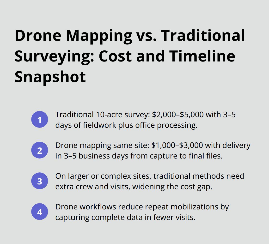
For construction projects, this speed translates directly into schedule savings. Every day saved on site surveying is a day your crews move into active construction, which on a Los Angeles project with $5,000 daily labor costs becomes substantial.
How Drones Reduce Labor and Equipment Costs
Equipment and labor efficiency explain the cost gap. Traditional surveyors require multiple personnel working on the ground, often in hazardous conditions near traffic or unstable terrain, which drives up insurance costs and safety protocols. Drone operators complete the same work with one or two people controlling the aircraft from a safe location, collecting data that’s already georeferenced and ready for processing.
Software like Pix4D or DJI Terra automates much of the image stitching and model generation, eliminating weeks of manual drafting that traditional surveys require. This automation reduces the skilled labor hours needed to transform raw data into usable outputs, cutting project timelines and associated overhead costs significantly.
Accuracy Prevents Expensive Rework
The real value emerges when you factor in accuracy. Drone-derived orthomosaics and 3D models eliminate measurement errors from manual field notes and hand-drawn sketches, preventing costly rework on construction sites. Contractors who switch to drone surveying catch design conflicts and site condition changes before they become expensive field problems.
For real estate developers in Los Angeles, drone photography and 3D models also replace expensive professional photography sessions, delivering marketing-ready visuals alongside technical survey data in a single project. This dual-purpose output means you pay once and receive both technical and marketing deliverables, compressing project budgets further.
The combination of lower upfront costs, faster timelines, and elimination of rework errors makes drone mapping the more economical choice for most Los Angeles projects-and the accuracy advantage becomes even more valuable when you consider how these precise outputs support the design and planning phases that follow.
Where Drone Mapping Delivers the Biggest Impact in Los Angeles
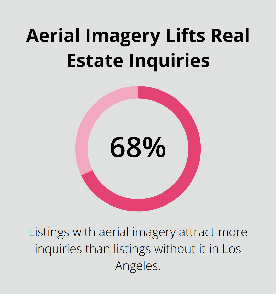
Real estate developers, construction managers, and infrastructure teams across Los Angeles now rely on drone mapping because the technology solves specific, expensive problems they face every day. The shift isn’t theoretical-it’s driven by measurable outcomes that directly affect project timelines and budgets. Real estate agents in Los Angeles use drone photography to increase property inquiry rates, with agents reporting that listings with aerial imagery attract 68% more inquiries than listings without it. For developers, 3D models and orthomosaics replace expensive professional photography sessions while simultaneously providing technical survey data, eliminating the need to pay separately for marketing visuals and site documentation.
Property tours created from drone footage allow remote buyers to assess vacant land or development sites before visiting in person, compressing sales cycles and reducing travel time for serious prospects.
Construction Projects Move Faster With Aerial Progress Tracking
Construction sites in Los Angeles generate constant demands for progress documentation, site surveys, and quality verification. Drone mapping addresses all three in a single deployment. Contractors measure material stockpile volumes with centimeter-level accuracy using orthomosaics, preventing overordering or shortages that delay work. Time-lapse drone footage captured weekly or daily reveals whether subcontractors meet schedule benchmarks, enabling project managers to intervene before delays cascade across dependent trades. As-built comparisons-overlaying drone-captured 3D models against original CAD designs-catch installation errors before concrete sets or walls close, preventing costly rework. General contractors managing multiple Los Angeles sites report that weekly drone surveys cost $800 to $1,500 per site but save $5,000 to $15,000 in avoidable rework through early conflict detection. Site surveying, which traditionally required two to three days of ground-based work, now completes in hours, accelerating permit approvals and keeping project schedules intact.
Infrastructure Inspections Eliminate Dangerous Fieldwork
Bridges, electrical transmission towers, water treatment facilities, and building facades in Los Angeles demand regular inspections to catch deterioration before failure occurs. Traditional inspection methods require workers to access hazardous locations using lifts, rope systems, or scaffolding-expensive and dangerous work that exposes personnel to falls and traffic hazards. Drone-mounted thermal cameras and high-resolution RGB sensors capture detailed imagery from safe distances, eliminating ground-level risk entirely. Infrastructure operators use thermal imaging to identify electrical hotspots on power lines and transformer stations before they fail, preventing outages across entire neighborhoods. Building managers inspect roof conditions, HVAC equipment, and structural cracks using drone-captured imagery without deploying crews to heights where falls remain the leading cause of workplace fatalities in construction. A single drone inspection of a six-story commercial building costs $1,500 to $2,500 and completes in one day, whereas traditional rope-access inspection runs $5,000 to $8,000 and requires multiple days of setup and safety protocols. Thermal imaging capabilities reveal energy leaks and roof defects, delivering actionable data that property managers use to prioritize repairs and optimize maintenance budgets.
Final Thoughts
Drone mapping Los Angeles projects demands operators who understand FAA regulations, navigate complex airspace restrictions, and produce outputs your team can actually use. Professional services eliminate the compliance risk and guesswork that come with hiring inexperienced operators or attempting flights without proper certification. FAA Part 107 certification separates qualified pilots from amateurs-certified operators pass rigorous testing on airspace rules, weather assessment, and emergency procedures, then apply that knowledge to Class B airspace restrictions around major airports and Los Angeles Municipal Code limits that take effect January 1, 2027 under AB 2113.
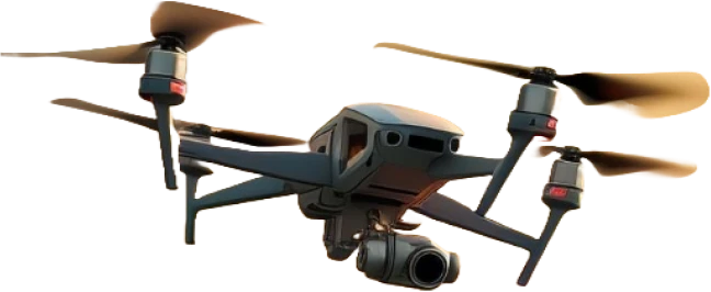
Equipment quality directly impacts data reliability and project outcomes. Professional operators invest in enterprise-grade drones like the DJI Phantom 4 RTK or Mavic 3 Enterprise, paired with high-resolution RGB cameras and thermal sensors that capture the detail your project demands. These platforms deliver centimeter-level accuracy through RTK workflows and ground control point integration, while thermal imaging reveals roof defects, energy leaks, and equipment failures that standard cameras miss entirely. Fully insured operations with $2 million in liability coverage protect your company if equipment fails or causes property damage-professional operators carry this coverage as standard practice, whereas uninsured operators leave your project exposed to financial and legal risk.
We at IE Drone Services combine FAA certification, advanced thermal and imaging technology, and actionable data delivery to support your project from planning through completion. Your team receives orthomosaics you can measure, 3D models that integrate into CAD workflows, and thermal reports that identify specific problem areas-all formatted for immediate use in your existing systems. Contact us for a free quote and see how professional drone mapping accelerates your next project.