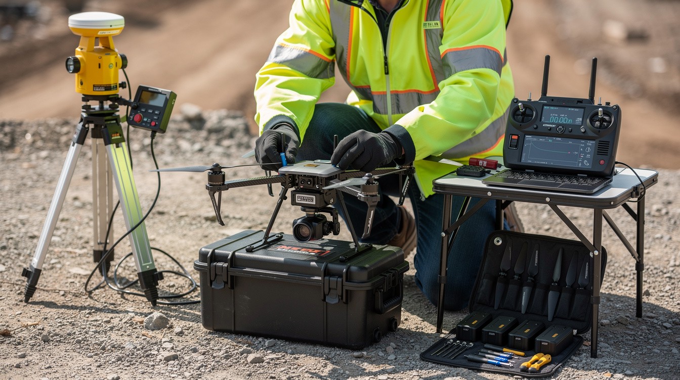
Drone mapping jobs are reshaping how industries approach surveying, construction, and land management. The demand for skilled drone operators continues to grow, with companies across multiple sectors actively hiring.
At IE Drone Services, we’ve seen firsthand how professionals with the right qualifications can build rewarding careers in this field. This guide walks you through the certifications, skills, and opportunities you need to know.
What Qualifications You Actually Need
FAA Part 107 Certification Is Non-Negotiable
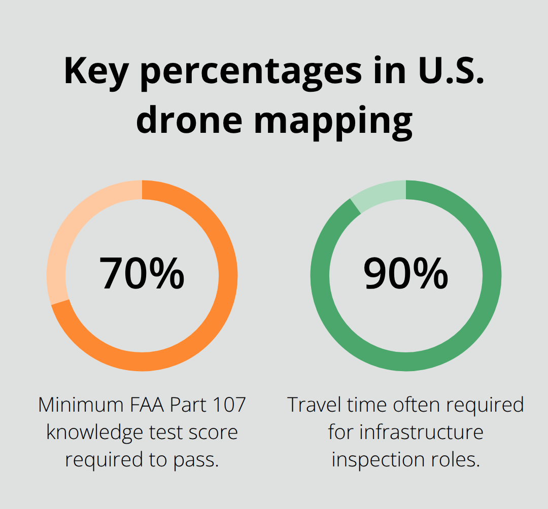
FAA Part 107 certification separates commercial drone operators from hobbyists in the United States. You must pass the FAA knowledge test, which covers airspace regulations, weather interpretation, and emergency procedures. The exam costs $175 and requires a minimum score of 70 percent. Most candidates study for two to four weeks before attempting it. This certification does not expire, though you must renew your airman certificate every two years through recurrent training. Without Part 107, you cannot legally accept payment for drone work-this eliminates the entire commercial market. The FAA projects 628,600 certificated remote pilots by 2030, up from 493,396 in 2025 according to the FAA Aerospace Forecast FY2026–2046, so competition intensifies rapidly. Start your Part 107 preparation immediately if you have not already, because it represents the baseline requirement that opens every door in this field.
Data Processing Determines Your Earning Potential
Flying the drone ranks as the easiest part of drone mapping work. The real income comes from processing data into deliverables like orthomosaics, Digital Elevation Models, and 3D point clouds. You need working knowledge of at least one major photogrammetry platform such as Pix4Dmapper, Agisoft Metashape, or DJI Terra. Most employers also expect GIS experience through ArcGIS or QGIS, since clients want their mapping data integrated into existing spatial workflows. Ground Sampling Distance calculations, real-time kinematic systems, and ground control point workflows become standard technical requirements across projects. If you cannot process imagery into actionable outputs, you remain just a drone pilot, not a drone mapper. According to the U.S. Skills Institute, data-to-deliverable skills including data processing pipelines and Python scripting gain increasing value alongside traditional flight capabilities. Invest time learning these tools before your first paid project, because clients expect professional-grade outputs from day one.
Physical Demands Shape Your Daily Reality
Drone mapping work involves long days outdoors in varying weather conditions. You carry equipment that weighs 15 to 40 pounds depending on your drone platform, climb to high vantage points, and navigate difficult terrain to establish ground control points or capture oblique imagery. Infrastructure inspection work often requires 90 percent travel time, according to industry data, which means extended time away from home and irregular schedules. The work also demands precision and attention to detail because a single miscalibrated camera or missed ground control point ruins hours of flight time and processing work.
You need steady hands for equipment setup, strong spatial reasoning for flight planning, and the discipline to repeat workflows consistently across dozens of projects. Physical fitness becomes a job requirement that separates professionals from hobbyists.
What Comes Next in Your Career Path
These qualifications form your foundation, but the job market itself offers multiple directions. Construction sites, agricultural operations, and government agencies all hire drone mapping professionals-each with different salary expectations and career trajectories.
Where Drone Mapping Jobs Actually Pay
Construction Sites Demand Specialized Mapping Skills
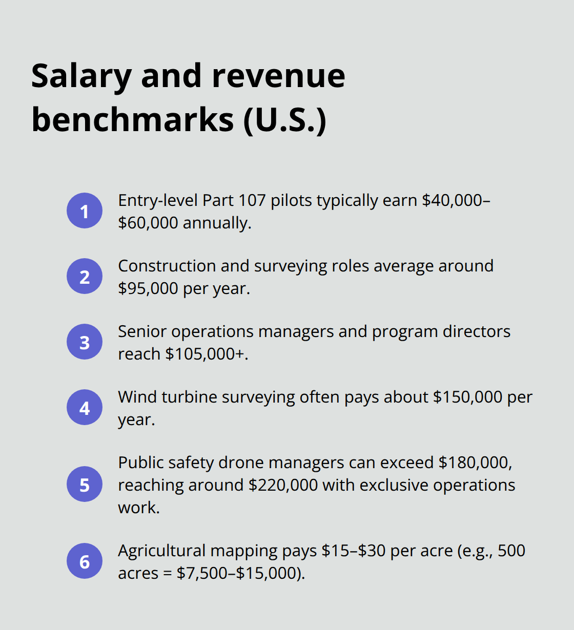
Construction companies hire drone mappers to track progress, calculate stockpile volumes, and conduct pre-construction surveys. A single large commercial project can generate $5,000 to $15,000 in mapping revenue, with experienced operators commanding $20,000 or more for complex site documentation. Construction and surveying drone roles earn around $95,000 per year according to industry data, though many pilots maintain a separate side business that adds additional income.
The key difference between average drone pilots and high-earning mappers is specialization. Construction firms need orthomosaics, Digital Surface Models, and volumetric calculations delivered on tight deadlines, not just aerial photos. You must understand how to plan flights for maximum accuracy, set up ground control points correctly, and deliver outputs that integrate directly into construction management software. Start with local construction contractors through LinkedIn and direct outreach, and build a portfolio with real projects that show before-and-after site documentation.
Agricultural Mapping Offers Seasonal Revenue Streams
Farmers use NDVI maps and multispectral imagery to monitor crop health, irrigation efficiency, and pest damage across hundreds of acres. Agricultural mapping work typically pays $15 to $30 per acre depending on the complexity of analysis, which means a 500-acre job generates $7,500 to $15,000 in revenue. The work is seasonal, peaking during spring planting and summer monitoring, so successful agricultural mappers diversify across regions or supplement with construction work during off-season months.
This sector rewards patience and regional knowledge but demands seasonal flexibility. You build relationships with farm operators over multiple years, which creates recurring revenue once you establish yourself in a region. The agricultural market continues to expand as farmers adopt precision agriculture practices to optimize yields and reduce input costs.
Government and Emergency Response Commands Premium Rates
Public safety drone managers with 15 years of experience and a fleet of 24 drones earn over $180,000 per year plus pensions, with potential to reach around $220,000 through exclusive UAS operations work. Law firms and forensic clients provide lucrative supplementary work, with typical fees around $1,000 to $1,500 for a few hours of specialized flight work. Wind turbine surveying commands approximately $150,000 per year for specialized drone surveying work, making it one of the most profitable niches available.
These positions typically require additional certifications beyond Part 107 and connections within local agencies. The stability and earning ceiling in government work exceed what most private sector roles offer, though the path to entry takes longer than construction or agriculture.
Choosing Your Specialization Path
The FAA projects 628,600 certificated remote pilots by 2030, which means competition intensifies rapidly across all three sectors. Your earning potential depends entirely on which sector you target and how deeply you specialize within it. Construction offers the fastest path to consistent income if you live near active development. Agriculture rewards patience and regional knowledge but demands seasonal flexibility.
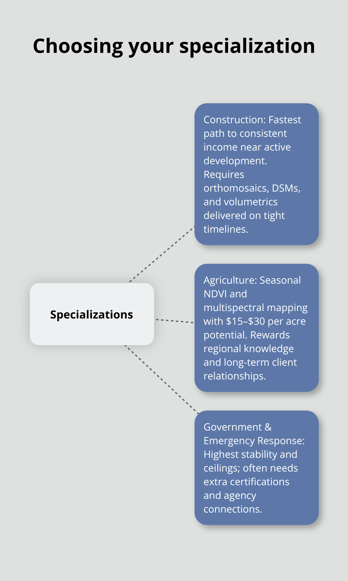
Government and emergency response positions offer stability and the highest earning ceilings, though they typically require additional certifications beyond Part 107 and connections within local agencies.
Each path requires different skills, networks, and geographic considerations. Your next step involves identifying which sector aligns with your location, experience level, and long-term career goals-because the job market rewards specialists far more than generalists.
Salary Expectations and Job Market Outlook
Entry-Level Drone Pilots Start Below $60,000
Entry-level drone pilots fresh from Part 107 certification typically earn between $40,000 and $60,000 annually if they secure consistent work, though this assumes full-time employment rather than freelance contracts. Most entry-level positions involve straightforward data collection on construction sites or agricultural operations, where you fly predetermined flight plans and hand off imagery to experienced data processors. According to U.S. Bureau of Labor Statistics OEWS data from May 2025, surveying and mapping technicians earn a national median of roughly $50,000 per year, which reflects the baseline compensation for drone mapping roles without advanced specialization.
The problem with staying at this level is that you remain replaceable. Experienced mappers who master data processing and GIS analysis earn $80,000 to $120,000 annually because they deliver complete project outcomes rather than just flight hours. A drone mapper with five years of experience who understands photogrammetry workflows, Ground Sampling Distance optimization, and Real-Time Kinematic accuracy commands significantly higher rates than someone who only knows how to launch a drone.
Senior Roles and Specialization Pay $105,000+
Senior operations managers and program directors in established drone services reach $105,000 or higher according to BLS data, particularly in regions with dense construction or energy infrastructure. The salary jump from pilot to data specialist is not automatic-it requires deliberate investment in software skills and project management experience. Wind turbine surveying in Great Plains states commands approximately $150,000 annually for specialized drone work, making it one of the highest-paying niches available. Public safety drone managers with 15 years of experience and a fleet of 24 drones earn over $180,000 per year plus pensions, with potential to reach around $220,000 through exclusive UAS operations work.
Geographic Location Determines Your Earning Ceiling
California and Washington consistently offer higher pay for data and analysis roles, with some senior data scientists earning $150,000 or more in tech-adjacent drone work. Construction-heavy regions like Texas, Florida, and Colorado reward mapping specialists with $90,000 to $130,000 salaries because demand outpaces supply. Rural agricultural regions typically pay less-$35,000 to $70,000 annually-because farming operations work with tighter margins and distribute mapping work across fewer specialists. International differences matter too; UK head pilots report around £45,000 annually, illustrating how regional regulatory contexts and market maturity affect compensation.
Market Saturation Accelerates in Major Markets
The FAA projects 628,600 certificated remote pilots by 2030, which means competition will intensify fastest in oversaturated markets like California and slowest in rural areas where drone services remain scarce. Your location decision should reflect not just current salary but also how rapidly the local market will saturate with competing operators. Moving to a region with active infrastructure projects, renewable energy development, or large-scale construction activity typically increases your earning ceiling by 40 to 60 percent compared to staying in markets where drone mapping remains a niche service.
Specialization Beats Geographic Advantage
Law firms and forensic clients provide lucrative supplementary work, with typical fees around $1,000 to $1,500 for a few hours of specialized flight work. The highest earners focus on narrow niches rather than competing as generalists across multiple sectors. Agricultural mapping work typically pays $15 to $30 per acre depending on the complexity of analysis, which means a 500-acre job generates $7,500 to $15,000 in revenue. Construction companies hire drone mappers to track progress, calculate stockpile volumes, and conduct pre-construction surveys, with a single large commercial project generating $5,000 to $15,000 in mapping revenue. Your earning potential depends entirely on which sector you target and how deeply you specialize within it.
Final Thoughts
Your path into a drone mapping job depends on three concrete decisions: obtaining Part 107 certification, mastering data processing software, and choosing a specialization that matches your location and interests. Entry-level positions start around $50,000 annually, but this baseline salary reflects pilots who only fly drones. The real income emerges when you become a data specialist who delivers orthomosaics, elevation models, and volumetric calculations that clients integrate directly into their workflows.
Construction mappers earn $95,000 annually on average, agricultural specialists command $15 to $30 per acre, and government roles reach $180,000 or higher with experience. Geographic location matters significantly-California and construction-heavy regions pay more, while rural areas offer less competition but lower compensation. The FAA projects 628,600 certificated remote pilots by 2030, so the window to establish yourself before market saturation closes rapidly.
Start with Part 107 certification immediately, then invest time learning Pix4Dmapper, Agisoft Metashape, or DJI Terra alongside ArcGIS or QGIS. Target your first clients through LinkedIn and direct outreach to local contractors, farms, or government agencies in your region, and specialize in one sector rather than competing as a generalist across multiple industries. We at IE Drone Services understand the technical demands of professional drone work and can help you navigate whether you want to build your own drone mapping business or explore career opportunities within a professional operation.