Intelligence gathering has shifted dramatically over the past decade. Drone ISR operations now deliver real-time data that traditional methods simply cannot match, making them indispensable for organizations handling time-sensitive decisions.
At IE Drone Services, we’ve seen firsthand how proper planning, execution, and analysis transform aerial intelligence into actionable results. This guide walks you through the practices that separate effective missions from costly mistakes.
Understanding ISR Operations and Drone Technology
What ISR Really Means and Why It Matters Now
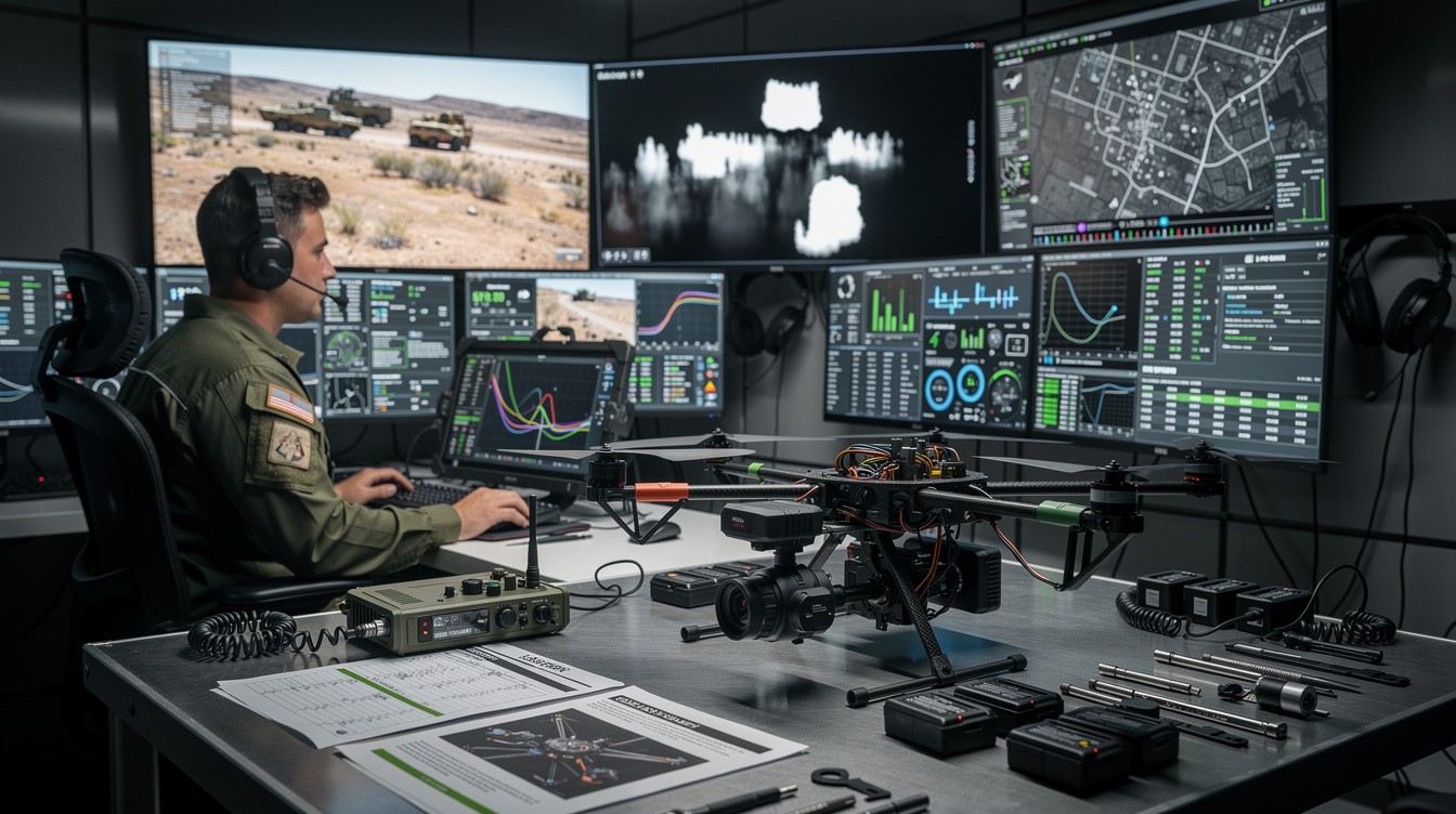
ISR stands for Intelligence, Surveillance, and Reconnaissance-a systematic process that transforms raw data into actionable intelligence. The critical distinction separates passive observation from true ISR: analysis converts a camera feed into insights that drive concrete decisions. In search-and-rescue operations, thermal imaging identifies heat signatures in seconds, cutting response times from hours to minutes. Infrastructure inspections produce detailed roof condition reports with specific repair recommendations rather than vague observations. Security monitoring shifts from watching footage to identifying patterns and threats before they escalate. Organizations that treat ISR as mere data collection waste resources and miss the window for effective response. The real value emerges when collection, analysis, and reporting form a complete cycle designed to answer specific operational questions.
Why Drones Have Become Essential for Intelligence Gathering
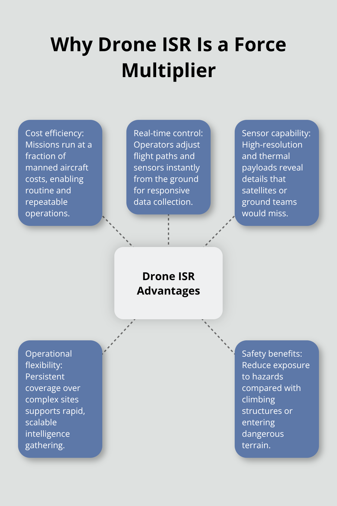
Drones have become the dominant ISR platform because they solve problems that traditional methods cannot address efficiently. Manned aircraft cost thousands per flight hour and require extensive airspace coordination, making them impractical for routine operations. Ground-based surveillance covers limited areas and misses what happens above eye level or in obscured locations. Drones deliver persistent aerial intelligence at a fraction of the cost while operators maintain real-time control from the ground. High-resolution and thermal cameras capture data that would require expensive satellite imagery or multiple ground personnel.
Key Advantages Over Traditional Methods
A thermal inspection that once took days of manual assessment now happens in a single flight. The FAA has certified drone operations across the United States, enabling reliable ISR capabilities for search-and-rescue, building inspections, and security monitoring. Organizations no longer choose between expensive traditional methods and no intelligence at all-they access professional aerial intelligence that adapts to their specific operational needs. Faster response times, safer operations, and measurable improvements in decision quality now define modern ISR programs. These advantages position drone-based intelligence as the practical standard for organizations that demand speed and precision.
How to Execute ISR Missions That Deliver Actionable Results
Define Your Intelligence Requirements First
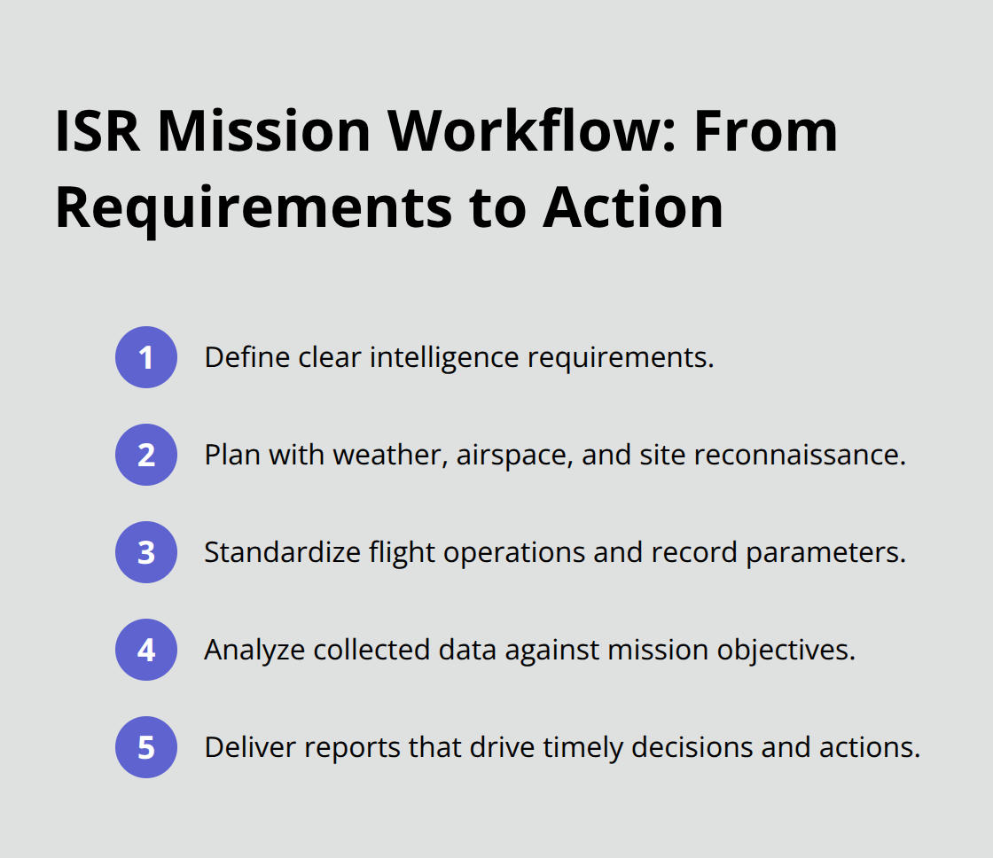
Effective drone ISR requires abandoning the assumption that flying a drone and collecting footage constitute a complete mission. The gap between raw data and actionable intelligence determines whether your operation succeeds or wastes resources. You must establish clear objectives before planning any flight-search-and-rescue teams need thermal signatures in precise locations, building inspectors need photogrammetry that shows material conditions, security operations need persistent monitoring patterns. Vague objectives produce vague results.
Prepare Your Mission With Precision
Pre-mission preparation establishes success criteria and identifies hazards before the aircraft leaves the ground. Weather data from the National Weather Service, airspace restrictions from the FAA’s B4UFLY app, and detailed site reconnaissance prevent costly delays and safety violations. You should document specific intelligence requirements that answer operational questions rather than simply collecting data. This preparation phase determines whether your mission delivers actionable insights or wastes time and resources.
Execute Flight Operations With Standardized Procedures
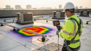
Flight operations demand consistent procedures that balance data quality with operational safety. Thermal cameras require specific altitude ranges to capture meaningful temperature differentials-typically 100 to 300 feet for building inspections where roof surface temperatures vary by 5 to 15 degrees Fahrenheit depending on insulation and solar exposure. High-resolution RGB cameras perform best between 200 and 400 feet altitude, delivering pixel density that reveals structural details without atmospheric distortion. Wind speeds above 15 miles per hour compromise data quality and increase flight risk, making weather assessment non-negotiable. You should record flight parameters, camera settings, and environmental conditions during every mission-this documentation enables post-mission analysis and creates the baseline for comparing results across multiple flights.
Transform Raw Data Into Actionable Intelligence
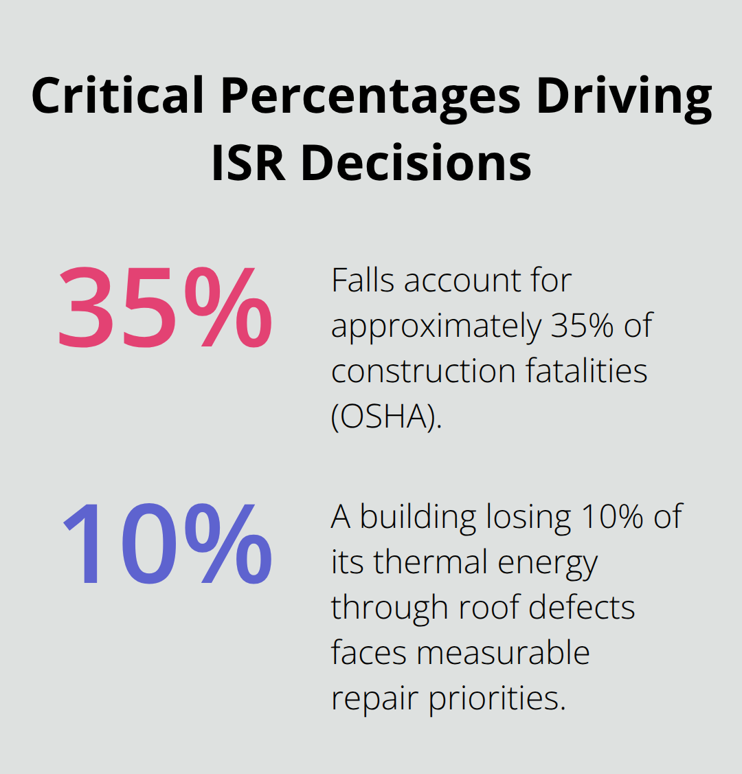
Post-mission analysis separates professionals from operators who simply collect footage. Raw footage becomes intelligence only when someone systematically reviews it against your original objectives, documents findings with specific evidence, and produces reports that guide concrete actions. Thermal analysis identifies heat loss patterns that correlate directly to energy costs-a building losing 10 percent of its thermal energy through roof defects faces measurable repair priorities. Infrastructure inspections produce repair lists ranked by severity and location rather than general observations. Security monitoring that identifies threat patterns enables preventive response instead of reactive crisis management.
Move From Analysis to Decision-Making
The mission concludes when decision-makers have the information they need to act, not when the drone lands. This distinction separates complete ISR operations from incomplete data collection efforts. Your analysis must answer the specific questions that prompted the mission in the first place, whether those questions involve search-and-rescue response times, property maintenance priorities, or security threat assessment. With this foundation in place, organizations can now examine how these practices apply across different operational contexts-from emergency response to infrastructure management to security operations.
Real-World Applications of Drone ISR
Search and Rescue Operations Transform Response Times
Search-and-rescue operations demonstrate why drone ISR transforms response times from hours into minutes. Thermal imaging identifies human heat signatures in darkness, dense vegetation, and adverse weather conditions where ground teams would spend days searching. Thermal cameras detect temperature differentials as small as 0.1 degrees Celsius, making them exponentially more effective than visual searching when conditions obscure visibility.
The operational advantage extends beyond speed. Rescue teams receive precise GPS coordinates rather than vague search zones, reducing wasted effort and improving safety for responders operating in hazardous terrain. This precision matters when minutes determine whether a rescue succeeds or fails.
Infrastructure Inspections Reveal Financial Stakes
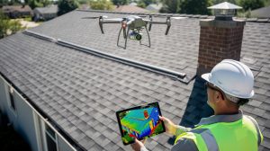
Roof inspections traditionally required workers to physically climb structures, creating fall hazards that account for approximately 35 percent of construction fatalities according to OSHA data. Thermal cameras identify heat loss patterns that correlate directly to energy waste. High-resolution RGB imaging captures material degradation, membrane damage, and structural concerns with pixel density that reveals details impossible to see from ground level.
Property managers gain actionable repair lists instead of vague observations, enabling them to prioritize maintenance spending and prevent costly emergency repairs. Solar panel inspections benefit similarly-thermal imaging identifies underperforming cells and connection failures that reduce energy output, according to the Solar Energy Industries Association.
Security Operations Establish Preventive Monitoring
Security operations leverage drone ISR for persistent monitoring that identifies threat patterns before escalation occurs. Perimeter surveillance establishes baseline activity patterns, making intrusions, unauthorized access attempts, and suspicious behavior immediately apparent when deviations occur. This pattern-based approach enables preventive response instead of reactive crisis management, fundamentally changing how security operations function.
Organizations that implement drone-based security monitoring shift from passive observation to active threat detection. The ability to monitor large areas consistently (without the fatigue that affects human observers) creates operational advantages that traditional surveillance cannot match. IE Drone Services delivers these capabilities using FAA-certified operations with thermal and high-resolution cameras specifically configured for the operational demands that separate effective ISR from data collection exercises.
Final Thoughts
Effective drone ISR operations require three interconnected elements working together: clear intelligence objectives, standardized execution procedures, and rigorous post-mission analysis. Organizations that skip any of these components waste resources and miss the actionable insights that drive better decisions. The practices outlined in this guide separate missions that deliver measurable results from operations that simply produce footage.
Professional drone services eliminate the guesswork by combining FAA certification, specialized equipment, and operational expertise that transforms raw aerial data into intelligence you can act on immediately. Search-and-rescue teams receive precise coordinates instead of search zones, property managers get repair lists ranked by severity and cost impact, and security operations identify threat patterns before incidents occur. This consistency matters because it means your organization receives the same quality of intelligence across every mission, regardless of complexity or conditions.
When your organization needs drone ISR operations that deliver results, contact IE Drone Services to discuss how professional aerial intelligence can improve your operations.