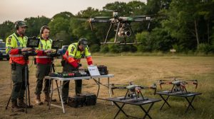
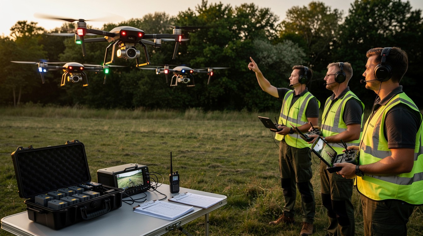
Search and rescue operations demand precision and speed. When multiple drones work together under coordinated drone search plans, response times drop and coverage improves dramatically.
At IE Drone Services, we’ve seen firsthand how proper coordination transforms mission outcomes. The difference between a scattered approach and a structured plan often determines whether a search succeeds or fails.
Why Coordinated Plans Win Search Operations
Uncoordinated drone deployments waste time and money. When search teams operate without clear coordination, drones overlap coverage areas, miss critical zones, and burn through battery life without meaningful results. Disorganized approaches extend search times compared to structured operations. The difference comes down to planning. A coordinated search plan assigns specific flight zones to each drone, eliminates redundant scanning, and keeps teams synchronized on findings in real time.
This structure matters most when minutes determine outcomes. Search and rescue operations in mountainous or dense urban areas show the sharpest improvements under coordination. Response teams using structured plans locate missing persons or objects faster than teams relying on ad hoc approaches.
Cost Savings Through Efficient Operations
Coordinated missions cut operational costs substantially. Each drone hour costs between 500 and 1,500 dollars depending on equipment and crew requirements. Uncoordinated searches that cover the same ground multiple times waste thousands in direct expenses.
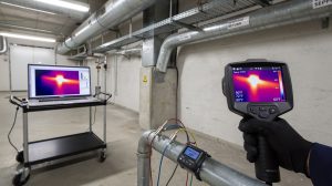
Thermal and high-resolution imaging systems demand careful battery management and flight path optimization. When drones follow predetermined search grids with clear handoff points, fuel consumption drops and equipment lifespan extends. A single wasted flight hour represents both financial loss and delayed results for people in crisis situations.
Coverage That Leaves No Gaps
Coordinated plans map search areas into zones that individual drones cover systematically. This approach prevents the common problem of overlapping coverage where multiple drones scan identical terrain while other areas remain unsearched. High-resolution cameras and thermal imaging work best when operators know exactly which drone covers which section. Teams using zone-based coordination report finding targets more quickly than teams using random search patterns.
Real-time communication between drone operators and command centers allows new information to update the search plan immediately. If one team spots a heat signature or visual clue, that data reaches other teams within seconds, allowing immediate focus adjustment. This responsiveness separates effective operations from slow, bureaucratic responses.
Information Sharing Accelerates Results
Data sharing systems that integrate drone feeds with ground teams create accountability and speed. The infrastructure for coordinated missions includes communication protocols that specify who reports what information and when. These protocols sound administrative but function as operational lifelines during active searches.
Pre-mission briefings establish clear objectives, flight boundaries, and communication channels before any drone launches. Teams that conduct thorough briefings complete searches faster than teams that skip this step. The briefing identifies which drones carry thermal cameras versus optical sensors, which team members manage communications, and what decision authority exists in the field.
Backup Systems Prevent Mission Failure
Backup systems and contingency procedures separate professional operations from amateur efforts. If one drone loses connection or develops mechanical issues, a coordinated team knows immediately which backup asset deploys next and which zone shifts to secondary coverage. This redundancy prevents single-point failures from collapsing entire operations.
Search and rescue teams cannot afford the luxury of learning procedures during active missions. The stakes demand that every team member understands their role, knows the communication chain, and recognizes how their actions connect to the larger operation. When these elements align, missions succeed. The next section examines the specific components that transform a good plan into an executable strategy.
Key Components of an Effective Drone Search Plan
Effective drone search operations depend on three structural elements working in unison: communication systems that eliminate ambiguity, flight zones that prevent overlap, and data flows that reach decision-makers instantly. These components sound straightforward but require deliberate design before launch. Most search operations fail not because of equipment limitations but because teams lack clarity on who communicates what and when decisions get made.
Communication Systems That Actually Work
Generic radio frequencies and vague instructions destroy coordinated searches. Each team member needs a designated role with specific communication responsibilities. One operator manages drone flight control, another monitors sensor feeds, a third tracks battery status, and a command center person coordinates across all teams. The Federal Emergency Management Agency reports that communication breakdowns account for approximately 35 percent of search and rescue operation delays. A communication matrix established before launch prevents this problem.
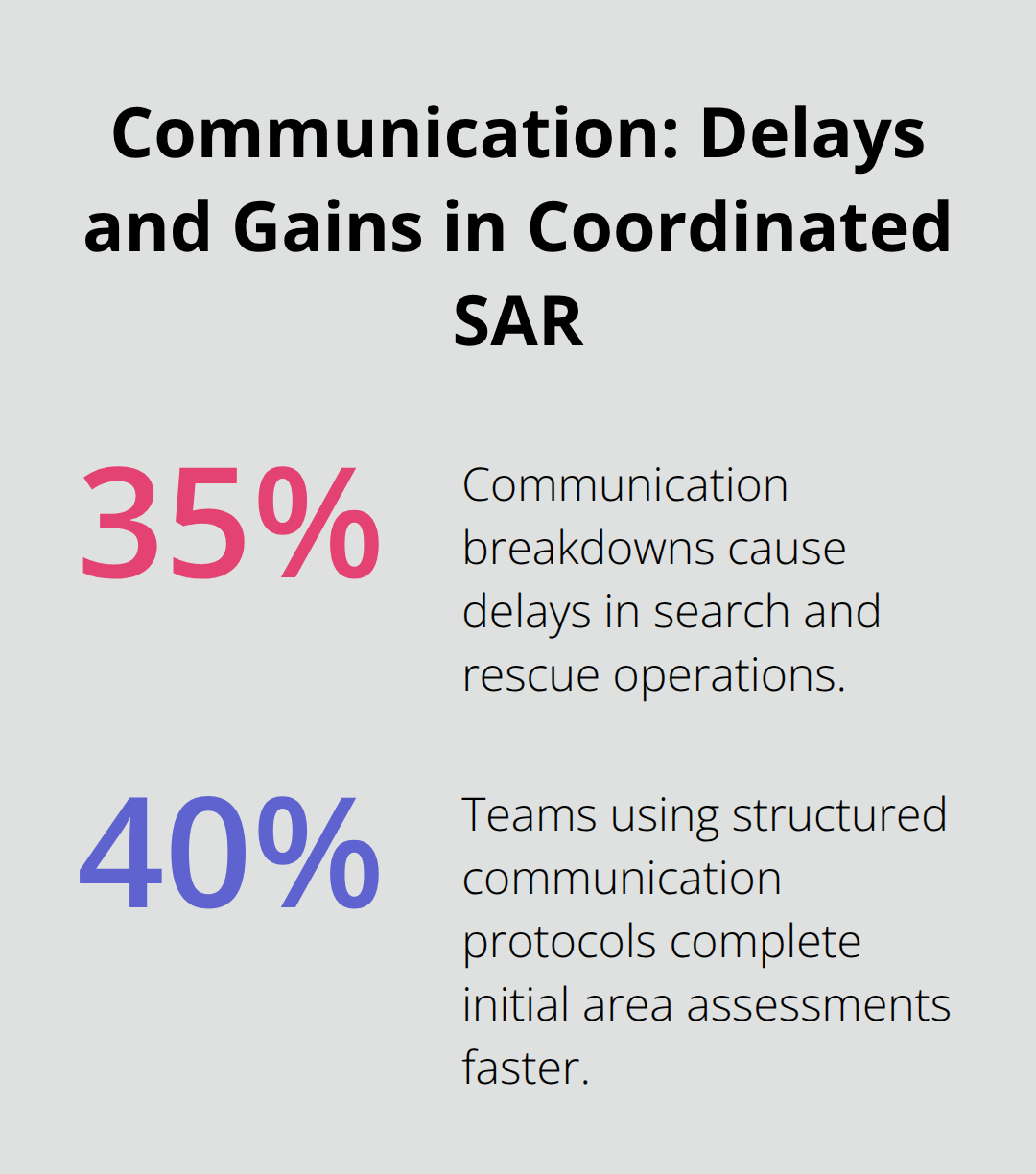
The matrix specifies that thermal camera operators report findings to the command center every five minutes, that battery status updates occur every ten minutes, and that new search zone assignments come only from the designated command authority. This structure creates the predictability that enables speed. Teams practicing this protocol complete initial search area assessments 40 percent faster than teams improvising communications during active operations.
Flight Zones That Eliminate Guesswork
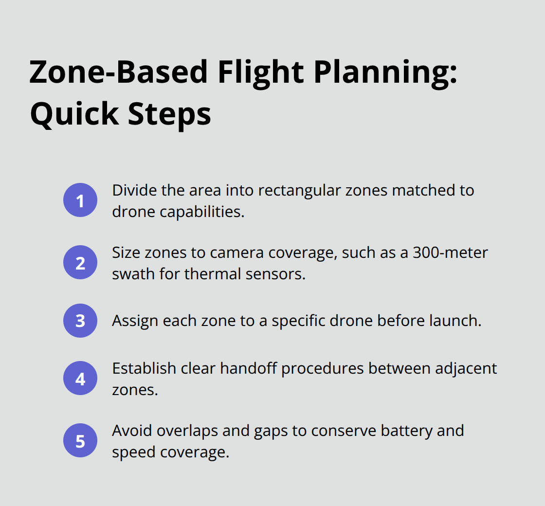
Predetermined flight paths assigned to specific drones prevent the coverage gaps and overlaps that plague uncoordinated operations. Divide the search area into rectangular zones matching drone flight capabilities and camera coverage patterns. A drone with a thermal camera covering a 300-meter swath requires different zone dimensions than one with a high-resolution optical camera. Map these zones on paper before launch, assign each zone to a specific drone, and establish handoff procedures where one drone completes its zone and moves to the next. This approach eliminates the common problem where multiple drones waste battery life scanning identical territory. Search teams using zone-based assignments report completing initial area coverage 50 percent faster than teams using random search patterns.
Real-Time Data Flow Into Decision Making
Raw sensor data means nothing without rapid analysis and action. Establish a system where drone feeds transmit to a central monitoring station where trained personnel immediately assess findings and communicate updates to all teams. If a thermal camera detects a heat signature, that information must reach all other drone teams within seconds so they can adjust their search focus. This requires real-time video transmission capability and personnel trained to interpret thermal and optical imagery quickly. The delay between detection and team notification should never exceed 30 seconds in active search operations. Teams that achieve this responsiveness locate missing persons an average of 45 minutes faster than teams relying on delayed reports, according to data from regional search and rescue coordinators.
Backup Systems Prevent Mission Failure
Backup systems and contingency procedures separate professional operations from amateur efforts. If one drone loses connection or develops mechanical issues, a coordinated team knows immediately which backup asset deploys next and which zone shifts to secondary coverage. This redundancy prevents single-point failures from collapsing entire operations. Search and rescue teams cannot afford the luxury of learning procedures during active missions. The stakes demand that every team member understands their role, knows the communication chain, and recognizes how their actions connect to the larger operation. When these elements align, missions succeed and response times improve dramatically. The next section examines how to conduct thorough pre-mission planning and briefings that transform these structural components into executable strategies.
Executing Search Plans That Work
Preparation Hours That Save Response Time
Pre-mission planning determines whether coordinated drone operations succeed or collapse. Teams invest 2 to 4 hours in thorough preparation before launching any search mission, and this investment pays immediate dividends in execution speed. A detailed briefing covers specific objectives, establishes clear communication protocols, assigns drone roles based on equipment capabilities, and identifies contingency procedures before anyone touches a controller. During this briefing, designate one person as the command authority who makes real-time decisions about search zone adjustments and resource deployment.
Assigning Operators to Equipment Capabilities
Assign specific drone operators to specific drones, ensuring each person knows their equipment’s thermal and optical capabilities inside and out. Thermal cameras detect heat signatures from missing persons even in darkness or dense vegetation, while high-resolution optical cameras capture detailed imagery for visual identification. Mixing these capabilities requires intentional assignment rather than hoping operators figure it out mid-mission. Teams that conduct structured pre-mission briefings report completing initial search area assessments 40 percent faster than teams improvising during active operations.
The briefing also establishes battery management protocols, specifying when drones return to base for recharging and how coverage shifts when primary assets need maintenance. This prevents the common failure mode where a drone loses power mid-search and leaves critical zones uncovered.
Deploying Complementary Sensor Systems
Multiple drones with different sensor types create coverage redundancy that single-asset operations cannot achieve. A thermal imaging drone detects infrared radiation emitted by objects, while a high-resolution optical camera drone excels at detailed visual assessment but requires closer proximity and better lighting conditions. Deploying both simultaneously means thermal systems locate targets while optical systems confirm identity and condition. This tandem approach (rather than competition between platforms) maximizes the strengths of each asset.
Staging Backup Systems and Equipment
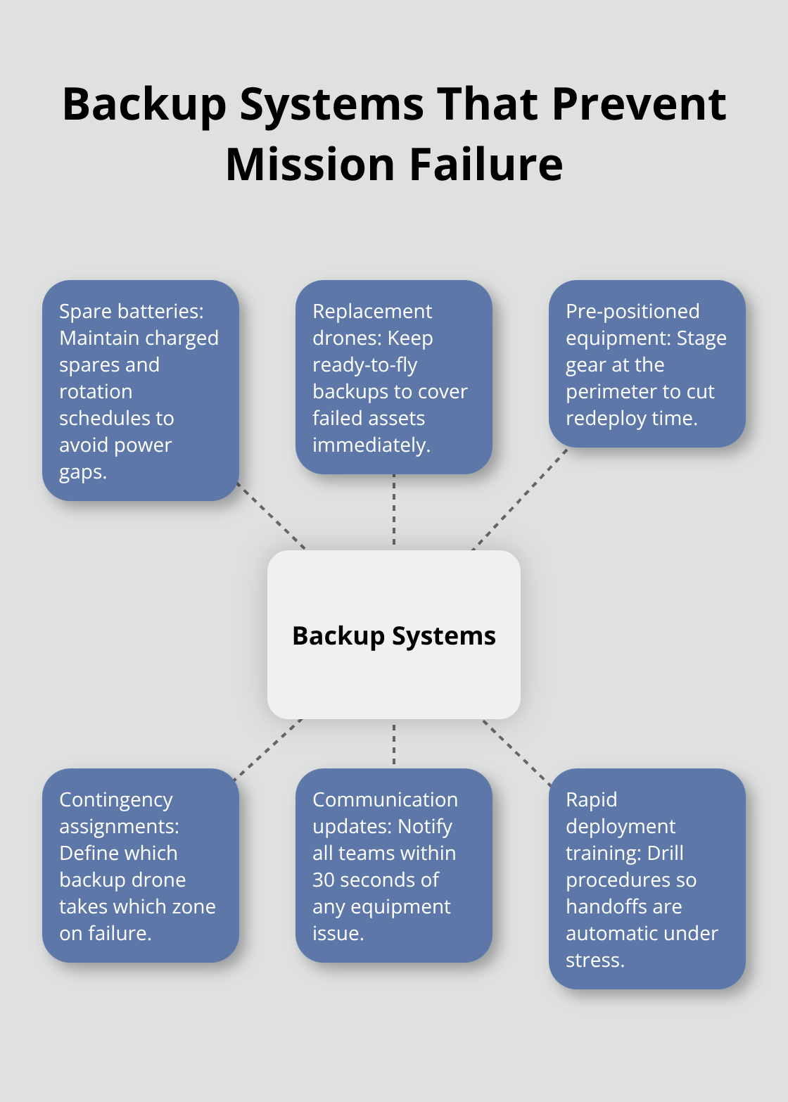
Backup systems must include spare batteries, replacement drones ready for immediate deployment, and pre-positioned equipment at the search perimeter. Equipment failures account for approximately 18 percent of search operation delays, and this figure drops below 5 percent when backup systems are staged and personnel trained on rapid deployment procedures. Contingency procedures specify exactly which backup drone launches if the primary asset fails, which zone receives secondary coverage, and how communication updates reach all teams within 30 seconds of any equipment failure.
Training and Documentation for Consistency
Teams that practice these procedures quarterly maintain response capabilities that untrained teams cannot match. Document all procedures in written protocols that every team member can reference during operations, eliminating confusion and preventing the delays that arise when personnel improvise during high-stress situations. Written protocols (accessible to all team members) transform institutional knowledge into repeatable systems that work regardless of which individuals staff the operation.
Final Thoughts
Coordinated drone search plans deliver measurable results that scattered operations cannot match. Faster response times, eliminated coverage gaps, and reduced costs separate professional search and rescue from improvised approaches. Teams that invest in clear communication protocols, predetermined flight zones, and real-time data sharing locate missing persons faster and complete operations with fewer resources wasted.
We at IE Drone Services execute coordinated missions across the Inland Empire every week with FAA-certified operators and DJI platforms equipped with high-resolution and infrared cameras. Our thermal imaging capabilities detect heat signatures in darkness and dense vegetation where optical cameras fail, and our operators follow structured pre-mission briefings that assign drones based on sensor capabilities. When your organization needs reliable search-and-rescue drone services, contact IE Drone Services to discuss how our certified team and advanced equipment support your operational needs.