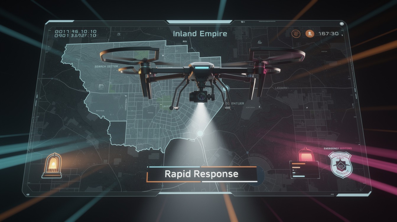
When someone goes missing in the Inland Empire, every minute counts. Drones have fundamentally changed how search and rescue teams locate people in remote areas, dense terrain, and low-visibility conditions.
At IE Drone Services, we’ve seen firsthand how this technology accelerates response times and brings people home safely. This guide shows you exactly how Inland Empire drone search operations work and why they’re becoming essential to public safety.
How Drones Cover Ground Faster Than Traditional Search Teams
Speed Advantage in Sprawling Terrain
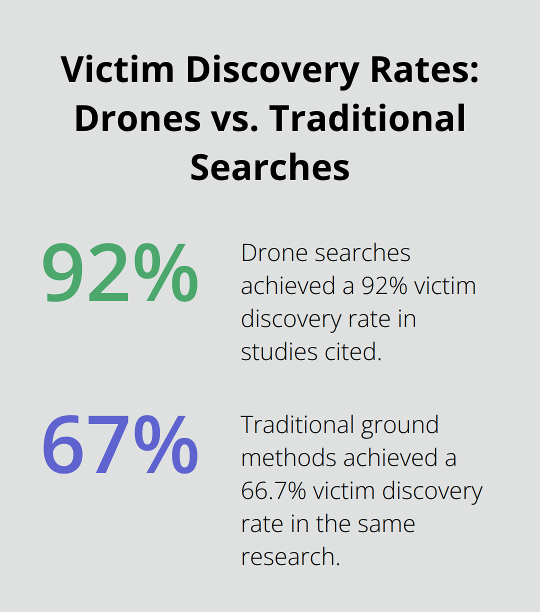
Drones reach incident scenes in minutes, often before ground units arrive. Research from Claesson et al. and Karaca et al. shows drones cover significantly larger areas than foot searches: drones surveyed 4,590 square meters compared to 2,600 square meters in one study, and 228,613 square meters versus 88,322 square meters in another. This difference matters when someone’s life depends on speed. Pardo-Ríos et al. found that drone searches located victims with shorter travel distances-920 meters for drones versus 1,091 meters for ground teams-and achieved a 92% victim discovery rate compared to 66.7% with traditional methods. In the Inland Empire’s sprawling suburban landscape and varied terrain, that coverage gap translates directly to faster rescues.
Real-Time Intelligence Before Ground Arrival
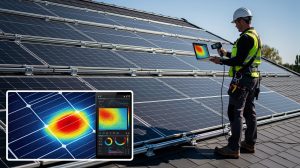
Ground teams waste time navigating obstacles and covering dead zones. Drones see everything immediately and relay live video feeds to first responders before they even arrive on scene. This aerial perspective lets dispatch and incident commanders make smarter decisions about where to send resources. Thermal imaging adds another critical advantage: drones equipped with infrared cameras detect heat signatures through smoke, fog, darkness, and dense vegetation where ground teams would search blind. High-resolution and infrared cameras designed for search and rescue deliver the data responders need in seconds, not hours.
Eliminating Personnel Risk in Hazardous Conditions
Reducing risk to personnel matters as much as speed. Ground searchers often work in dangerous terrain-steep ravines, dense brush, unstable structures, or hazardous weather. Sending a drone first eliminates unnecessary exposure. The drone identifies safe routes, maps hazards, and locates victims before personnel enter risky areas. In Corona’s Drone as First Responder program, pilots sometimes hear 911 calls in real time and deploy drones instantly, providing situational awareness that lets responders approach scenes with full knowledge of conditions.
Integrated Data for Prepared Response
This model has become standard operating procedure because it works: officers arrive prepared, safer, and faster. The integration of real-time video, thermal data, and precise location information creates a complete picture before boots hit the ground. For Inland Empire agencies, this means fewer personnel injuries, smarter resource allocation, and measurably faster response times that save lives. Understanding how drones deliver this intelligence is only part of the equation-the technology itself requires specific capabilities to perform in the Inland Empire’s unique environment.
What Drone Technology Powers Inland Empire Search Operations
Thermal Imaging Cuts Through Darkness and Poor Visibility
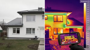
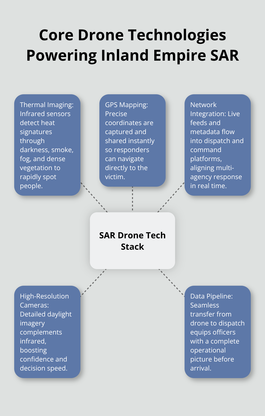
Thermal imaging is where drone search becomes genuinely effective in the Inland Empire’s challenging conditions. Infrared cameras detect heat signatures through darkness, fog, heavy vegetation, and smoke-situations where ground teams hit a wall. When someone goes missing at night or in poor visibility, a thermal-equipped drone sees what humans cannot. Corona’s Drone as First Responder program relies heavily on this capability, deploying thermal data to responders before they arrive on scene. The real advantage isn’t just seeing heat; it’s the speed. A thermal search that would take ground teams hours happens in minutes from above, and that time difference directly impacts rescue outcomes.
GPS Mapping Delivers Exact Victim Locations
GPS mapping and precise location tracking transformed how responders navigate to victims. Once a drone locates someone, the system records exact coordinates and transmits them to ground teams instantly. No more radio descriptions of landmarks or unclear directions-responders receive a pinpoint location and plot the fastest route. This precision eliminates wasted time and reduces the risk of searchers moving in wrong directions. The data flows directly into dispatch systems and incident command platforms across the Inland Empire, creating a unified operational picture.
Integration With Emergency Response Networks
Integration with local emergency response networks in the Inland Empire means drone data reaches decision-makers immediately. Corona’s Real-Time Information Center supplies additional context like vehicle data and background information, creating a complete operational picture. When multiple agencies coordinate on a search, shared drone feeds eliminate communication gaps and duplicate effort. Each responder sees the same information at the same time, which accelerates coordination and reduces confusion during critical moments.
High-Resolution Cameras Support Multiple Search Scenarios
High-resolution and infrared cameras work together to handle different search conditions. High-resolution cameras capture detail during daylight and clear conditions, while infrared cameras take over when visibility drops. This dual-camera approach means one platform handles varied terrain and weather across the Inland Empire without equipment swaps.
The data quality directly affects responder confidence and decision speed-poor imagery wastes time; clear data saves lives.
Building the Data Pipeline for Responder Success
The drone-to-dispatch pipeline works because it’s built around responder needs, not technology for its own sake. Agencies that implement this workflow see faster victim location, reduced personnel risk, and better coordination across jurisdictions. The next step involves understanding how agencies and drone operators coordinate these operations in real time, especially when weather and terrain create additional complexity.
Practical Implementation of Drone Search Operations
Establishing Clear Command and Coordination Protocols
Coordination between agencies and drone operators determines whether search operations succeed or stall. The Inland Empire’s multi-jurisdictional landscape means sheriff’s departments, fire services, police agencies, and volunteer rescue teams often respond to the same incident. When a drone operator deploys without clear communication channels to incident command, the technology becomes a liability instead of an asset. Effective operations require pre-established protocols: drone operators need direct radio contact with the incident commander, a designated frequency for real-time updates, and authority to make immediate deployment decisions. Corona’s Drone as First Responder model works because pilots hear 911 calls directly and deploy within seconds, cutting the communication chain that usually delays response. Inland Empire agencies should establish mutual aid agreements that designate which operator responds to which jurisdiction and clarify command authority before emergencies occur.
Planning for Weather and Environmental Constraints
Weather planning happens before launch, not after. Drones operate within strict parameters: wind speed limits typically max out at 25–35 mph depending on aircraft weight and design, visibility requirements demand daylight or equipped night-vision capability, and precipitation immediately grounds operations. The Inland Empire’s afternoon thermal winds and summer dust storms create genuine operational constraints that require real-time assessment.
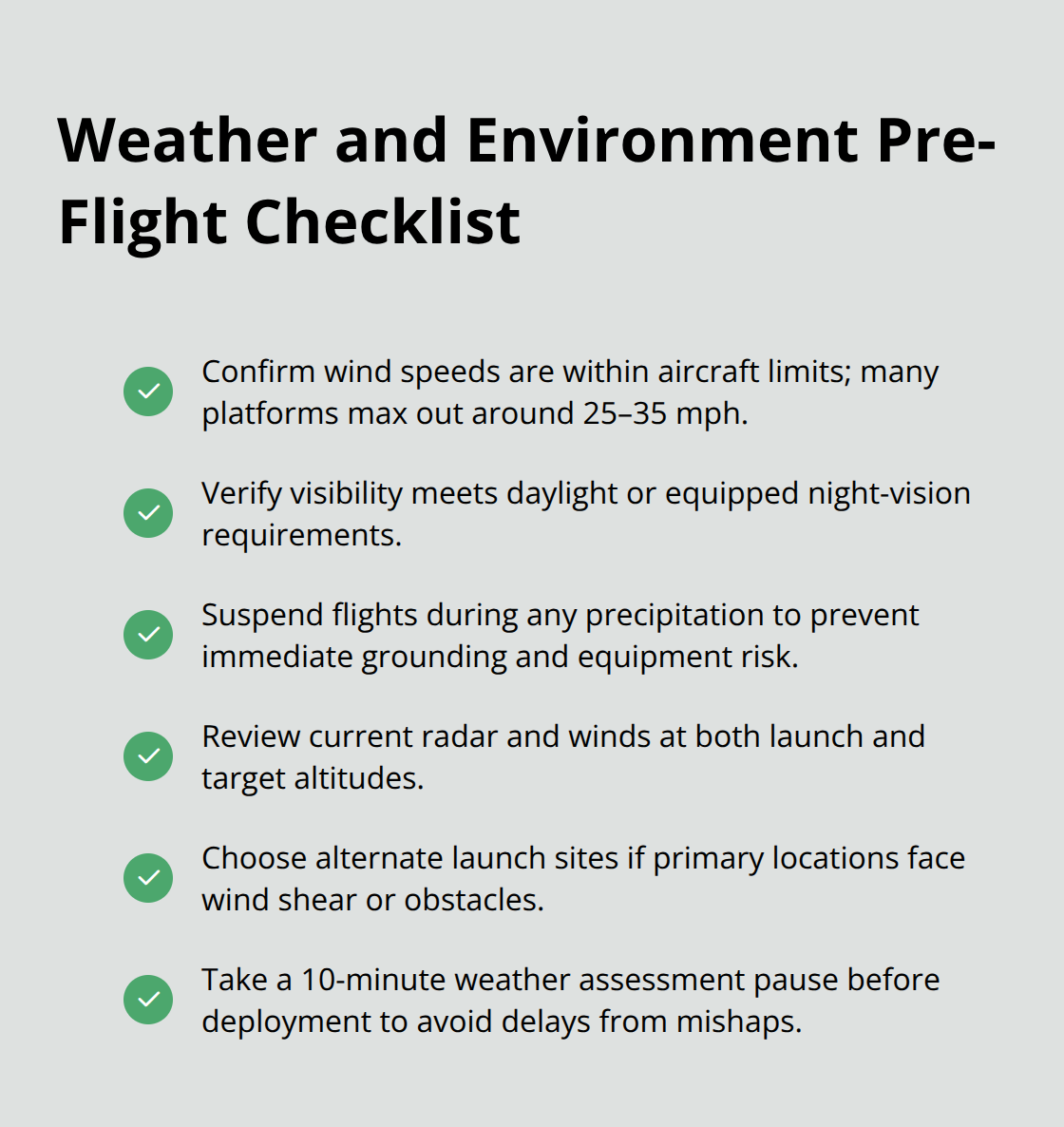
Operators need access to current weather radar, wind speed data at launch and target altitudes, and visibility reports specific to the search area. Flight planning should include alternate launch sites if primary locations face wind shear or obstacles. Responders often expect immediate drone deployment, but a 10-minute delay for proper weather assessment prevents crashes and lost equipment that would delay rescue further.
Transforming Raw Data Into Actionable Intelligence
Data analysis separates useful drone information from raw video footage. Thermal imagery requires trained interpretation: understanding thermal signatures and their interpretation in locating missing persons is essential for accurate analysis. High-resolution cameras capture detail that demands systematic analysis rather than casual observation. Incident commanders need operators who communicate findings clearly and distinguish between confirmed victim locations and areas requiring ground verification. Corona’s integration of drone feeds with Real-Time Information Center data demonstrates how supplementary intelligence accelerates decision-making through cost-effective, centralized policing that delivers life-saving results. Ground teams respond faster when dispatch provides not just aerial coordinates but also terrain assessment, hazard warnings, and vehicle descriptions from the drone footage.
Interpreting Environmental Features From Aerial Perspectives
The Inland Empire’s varied topography means drone operators must understand how elevation changes, vegetation density, and water features appear on thermal and visual feeds. Training operators to articulate these environmental factors transforms raw data into actionable intelligence. An operator who recognizes how a ravine appears on thermal imaging or how dense brush affects heat signature visibility communicates findings that responders can act on immediately. This expertise separates operators who simply fly aircraft from those who deliver intelligence that incident commanders can trust and act upon in critical moments.
Final Thoughts
Drone technology has fundamentally reshaped how the Inland Empire responds to missing persons and search emergencies. Response times have dropped from hours to minutes, victim discovery rates have climbed from under 67% to over 92%, and personnel risk has decreased substantially through remote aerial assessment before ground teams enter hazardous terrain. These measurable outcomes save lives in real operations across the region every single day.
Public safety agencies throughout the Inland Empire are adopting drone search capabilities at an accelerating pace. Corona’s Drone as First Responder program demonstrates the operational model that works: prepositioned aircraft, direct pilot access to 911 calls, real-time thermal and video feeds to incident command, and integration with dispatch systems. When drones arrive before ground units in roughly two-thirds of cases and provide situational awareness that lets responders approach scenes prepared and safer, adoption becomes inevitable.
If your agency or organization needs reliable Inland Empire drone search capabilities, IE Drone Services operates FAA-certified platforms equipped with high-resolution and infrared cameras specifically designed for search and rescue. Their thermal imaging delivers the precise location data that incident commanders depend on when response speed matters most. Contact them to discuss how drone search integration strengthens your emergency response capacity.