IE Drone Services & Inspection

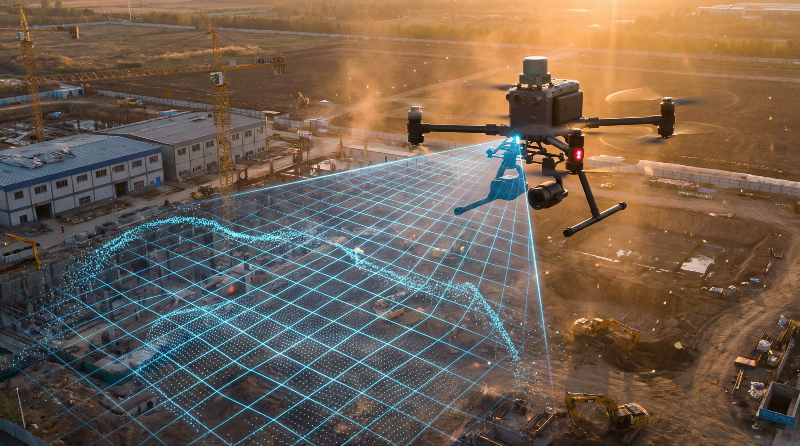
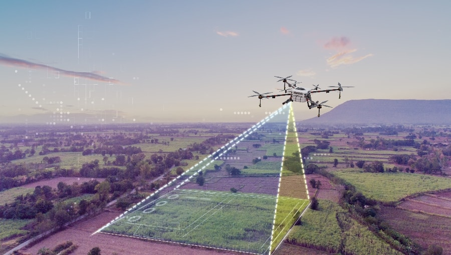
At IE Drone Services, we leverage advanced aerial technology to provide high-precision mapping, surveying, and traffic analysis solutions across the Inland Empire and Southern California. Our FAA-licensed pilots utilize state-of-the-art drones equipped with highresolution sensors to deliver actionable data for construction, real estate, urban planning, and infrastructure development
By choosing aerial data collection, you significantly reduce the time, cost, and safety risks associated with traditional ground-based surveying methods.
High-Precision Drone Mapping & Surveying
Whether you are breaking ground on a new commercial development or need accurate topographical data for land management, our drone mapping services provide the comprehensive insights you need to make informed decisions.
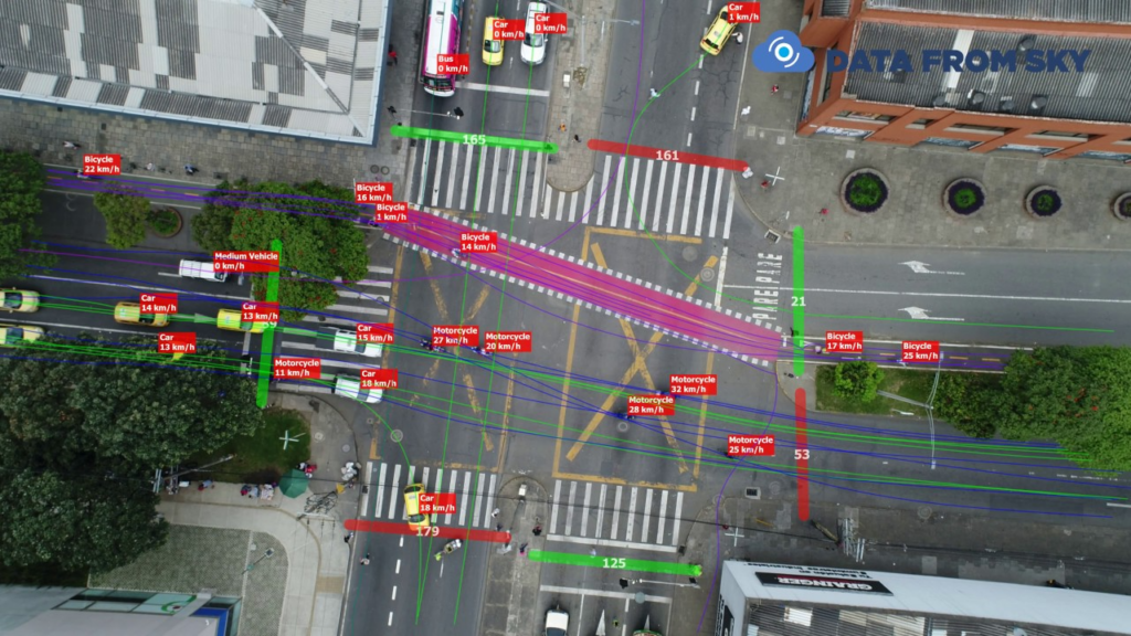
Advanced Drone Traffic Analysis
Understanding traffic flow is critical for urban planning, commercial real estate development, and event management. Traditional traffic studies often rely on limited ground-level observations or expensive helicopter flights. IE Drone Services offers a smarter, more comprehensive solution. Our drones provide an unobstructed, bird’s-eye view of intersections, parking lots, and roadways, capturing real-time data on vehicle movement and congestion patterns.
How Aerial Traffic Analysis Benefits Your Project:
Intersection & Roadway Studies
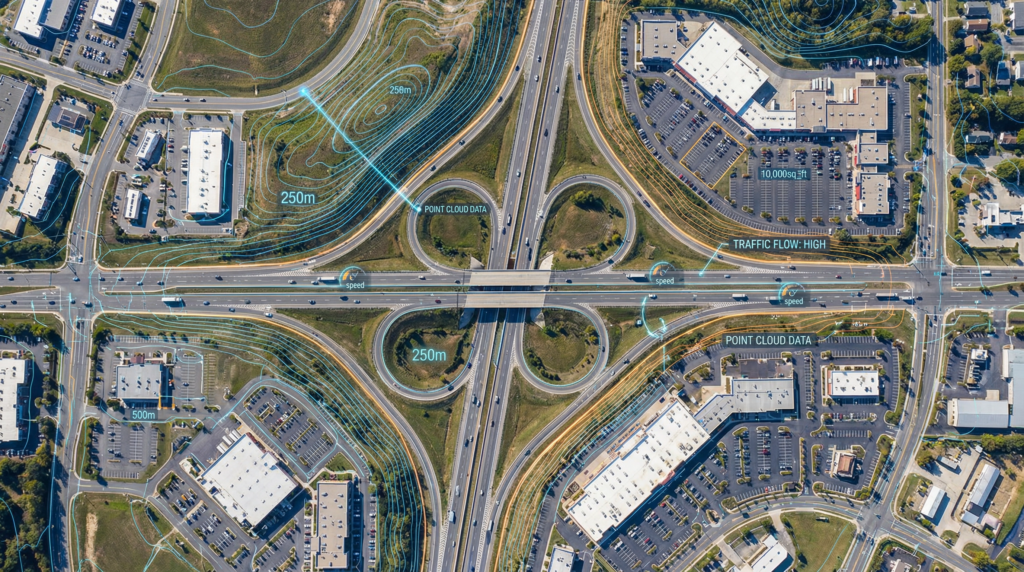
We capture high-definition video of complex intersections and traffic corridors during peak hours. This aerial perspective allows traffic engineers to analyze vehicle counts, turning movements, queue lengths, and pedestrian interactions with unparalleled clarity.
Parking Lot Utilization
For commercial developers and retail centers, understanding parking dynamics is crucial. Our aerial surveys can quickly assess parking lot occupancy rates, identify bottlenecks, and optimize traffic flow within large commercial complexes
Event Traffic Management
Managing the influx of vehicles for large-scale events requires real-time situational awareness. Our drone services provide event organizers and local authorities with the aerial oversight needed to monitor traffic buildup, optimize parking logistics, and ensure safe pedestrian access.
services
Our Mapping Deliverables Include:
We utilize advanced photogrammetry software to stitch together hundreds of highresolution
aerial images, creating highly accurate, measurable digital representations of
your site.
2D Orthomosaic Maps
We generate highly detailed, distortion-free 2D maps that provide a true top-down view of your property. These maps are ideal for site planning, measuring distances, calculating areas, and tracking construction progress over time.
3D Digital Elevation Models (DEM) & Point Clouds
Our 3D modeling services allow you to visualize the terrain in incredible detail. Digital Elevation Models and 3D Point Clouds are essential for topographical analysis, volumetric measurements (such as stockpiles or excavation sites), and integrating with CAD or GIS software.
Construction Progress Monitoring
Keep stakeholders informed and projects on schedule with regular aerial surveys. We can fly the exact same automated route weekly or monthly, providing a visual timeline of your construction site's progress from groundbreaking to completion.
Why Choose IE Drone Services?
FAA Part Certified
Fully licensed and insured for commercial drone operations.
Advanced Equipment
Utilizing high-resolution visual and thermal sensors for maximum data accuracy.
Local Expertise
Proudly serving the Inland Empire, Los Angeles, Orange, and San Diego counties with a deep understanding of the local terrain and airspace regulations.
Actionable Data
We don’t just provide pictures; we deliver measurable, high-quality data that integrates seamlessly into your existing workflows.
Ready to elevate your project with aerial data?
Contact IE Drone Services today to discuss your mapping, surveying, or traffic analysis needs and receive a customized quote.